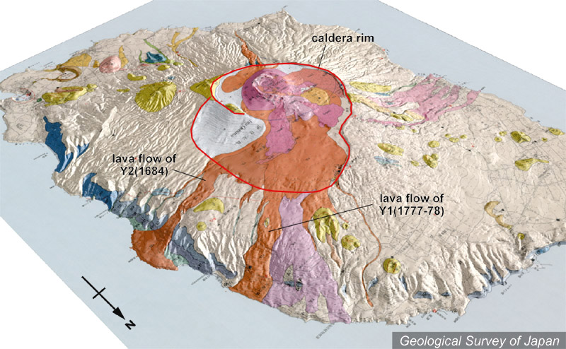
| 地質陰影図(北東→南西、40°)。カルデラ内から手前側に、1684年(左のオレンジ)と1777-78年(右のオレンジ)の溶岩流が海岸まで達している。 |
|
|
|
| 地質図:川辺禎久(1998)伊豆大島火山地質図。火山地質図10、地質調査所。 | |||
Topographic relief of Izu-Oshima combined with geological map (tilted by 40° from the NE to the SW). Lava flows of 1684 (orange color on the left) and of 1777-78 (orange color on the right) reached the coast. |
K. Nakajima |