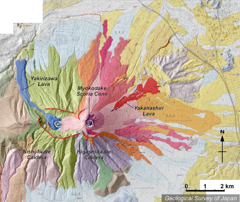
| 地質陰影図。岩手火山は西岩手火山と東岩手火山からなる。西岩手は頂部のカルデラ内に中央火口丘群があり、焼入沢溶岩が北西に流れ下っている。東岩手では山頂部に妙高岳スコリア丘がある。その北東、中腹から流出しているのが1732年の焼走り溶岩。 | |
|
|
| 地質図:伊藤順一・土井宣夫(2005)岩手火山地質図。火山地質図no.13、産業技術総合研究所地質調査総合センター。 | |||
Topographic relief of Iwate Volcano combined with geological map. Iwate Volcano is divided into Higashi (=east) Iwate and Nishi (=west) Iwate. Nishi Iwate has central cones from where Yakirizawa Lava flowed down. Higashi Iwate has Myokodake Scoria Cone at the summit and Yakahashiri Lava in 1732 erupted at the middle of northeastern slope. |
Map courtesy of K. Nakajima |
||