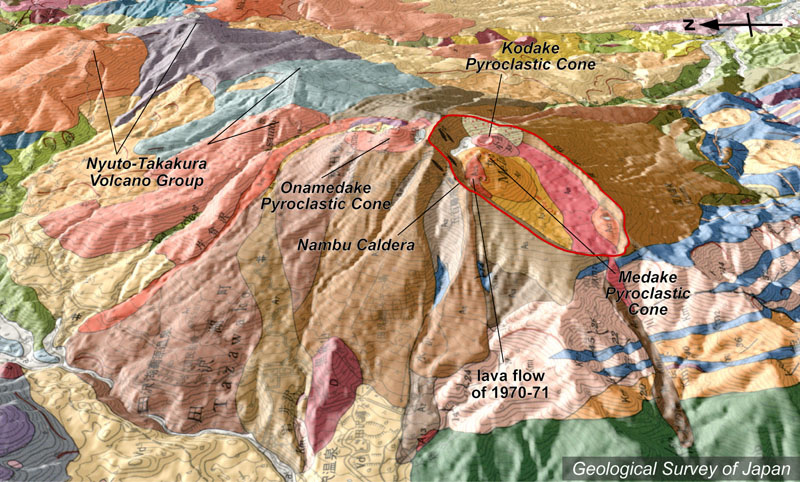
| 地質陰影図(西→東、25°)。山頂部から右手に南部カルデラ。その中に、女岳、小岳の2つの火口丘がある。女岳山頂部から手前に流れているのが1970-71年の溶岩流(赤色)。最高峰の女目岳はカルデラ外の左にある。それより左手は乳頭・高倉火山群(紫色や水色など)。 | |
|
|
| 地質図:須藤 茂・石井武政(1987)雫石地域の地質。地域地質研究報告(5万分の1地質図幅)、地質調査所、142p。 | |||
| Topographic relief of Akita Komagatake Volcano combined with geological map (tilted by 25°from the W to the E). Medake with 1970-1971 lava flows and Kodake are in Nambu Caldera. The highest point, Onamedake is located outside the caldera. | Map courtesy of K. Nakajima |
||