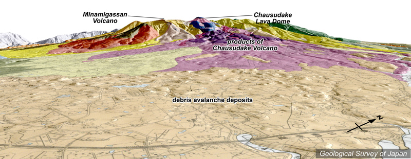
| 地質陰影図(南東→北西、0°)。手前に流れ山を持った岩屑なだれ堆積物が広がる。奥の中央が茶臼岳溶岩ドーム。 |
|
|
|
| 地質図:地質図:山元孝広・伴 雅雄(1997)那須火山地質図。火山地質図9、地質調査所。 | |||
Topographic relief of Nasu Volcano Group combined with geological map (from the SE to the NW). Debris avalanche deposits extend to the foreground. Chausu-dake Lava dome in the middle background. |
K. Nakajima |