日本の火山 > 第四紀火山 > 個別火山 > 画像集 > 画像
Volcanoes of Japan > Quaternary Volcanoes > Volcano > Photo Gallery > Image
燧ヶ岳 ______ Hiuchigatake |
SM |
|
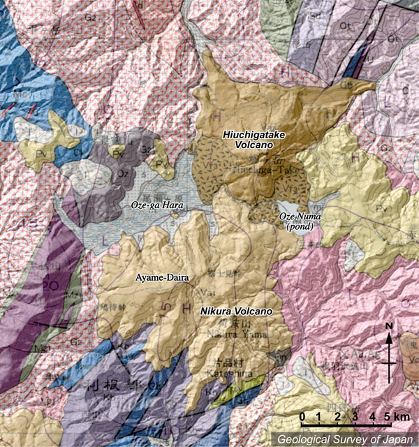
| 地質陰影図。尾瀬燧ヶ岳(上)と荷鞍岳-アヤメ平(下)。尾瀬燧ヶ岳火山の噴出物・崩壊堆積物が、堰止めによって尾瀬ヶ原と尾瀬沼を作った。 |
|
|
|
| 地質図:山元孝広ほか(2000)20万分の1地質図幅「日光」、地質調査所。 | |||
Topographic relief of Hiuchiga-take (north) and Nikura-Ayamedaira (south) volcanoes combined with geological map. Ozegahara (Oze upland bog) and lake of Ozenuma formed by damming up by volcaniclastics from Hiuchigatake Volcano. |
K. Nakajima |