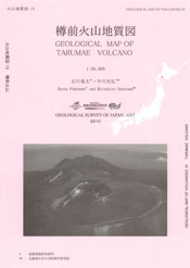
Tarumae Volcano
1: Introduction / 2: General Geology of Tarumae Volcano / 3:Topography of Tarumae Volcano
4: Eruptive history of Tarumae Volcano
5: Petrology of Tarumae volcano
6: Monitoring of volcanic activities/ 7: Factors for mitigating volcanic hazard
Acknowledgements / References
![]() PREV
PREV ![]() NEXT
NEXT
1: Introduction / 2: General Geology of Tarumae Volcano / 3: Topography of Tarumae Volcano
1: Introduction
The Tarumae Volcano(also known as Tarumai Volcano) is one of the Post-Shikotsu Caldera Volcanoes. It is a relatively new volcano beginning its activities from ca. 9,000 yBP. Since the 17th century at least six magmatic eruptions have been clarified. The largest eruptions occurred in 1667 and 1739. Those must have extensively affected surrounding culture and environment, but no detailed records of disaster are found yet. Since the eruption of 1909 (The 42nd year of Meiji), the Tarumae Volcano has not erupted magma. This is a contrasting feature comparing with adjacent Usu and Komagatake Volcanoes which are very active up to the present date. However, earthquakes and geothermal activities are both unrest. Here, the geology and eruptive history of the Tarumae Volcano are summarized which can be useful for long- and medium-term predictions of the activities. It is noted that Tarumae Volcano has also been spelt as Tarumai Volcano because in historical documents in Yedo Period such as Matsumae-Nennen-Ki, it was spelt as Tarumai (Tanakadate, 1917; Doi, 1957; Soya & Sato, 1980; Simkin et al., 1981). On the other hand, Geographical Survey and Meteorological Institutes are issuing their publications as Tarumae. In this report Romanized spelling of Tarumae is basically used. For radioactive carbon dates, correction with calendar years is adapted and shown as ka (cal.).Dates shown in Arabic numerals correspond to Gregorian and traditional lunar calendar dates are bracketed.
2: General Geology of Tarumae Volcano
Tarumae Volcano is in contact with Fuppushi Volcano and Lake Shikotsu in the north. Pyroclastic flow deposits erupted from Shikotsu Caldera underlies wide areas from the east to southeast sides of the Tarumae Volcano. In parts of west side the pyroclastic deposits directly cover Neogene sedimentary and volcanic rocks. The Neogene mudstone and sandstone beds are exposed in the southern slope of Mt. Morappu and upstream of Shishamonai (Doi, 1957). Pliocene andesites constitute Mts. Morappu and Tapukopu. Dacite lava of Mt. Monbetsu (eastern adjacent of the mapped area)on the eastern shore of Lake Shikotsu has 2.5±1.4 Ma in K-Ar age (Watanabe, 1993), which is believed to be coeval with Tarumaegawa Lavas.
The Lake Shikotsu is a cocoon-shaped caldera lake of 12km long and 6km wide. The first activity of the caldera is presumably ca. 60 ka or older which erupted pyroclastic fall (Ssfa)and pyroclastic flow (Ssfl)deposits. The extent of pyroclastic flow deposit is limited to the southern side of the caldera suggesting its eruptive source has been located at the southern part of the caldera. Around 40 to 45 ka the largest-scale eruption occurred with a large-scale pyroclastic flow accompanied with phreatomagmatic and Plinian eruptions resulting in formation of a caldera (Katsui, 1959; Yamagata, 1994; Machida & Arai, 2003). The eruptive vent of the Plinian eruption is estimated at the center of the present caldera and at the southwest when pyroclastic flow erupted suggesting migration or enlargement of the source vent (Yamagata, 1991). Pyroclastic fall deposit from Plinian eruption covers almost of Hokkaido Island except for southwestern district. The pyroclastic flow deposit is found in all directions of the caldera especially forming plateaus in northeastern and southwestern parts. Immediately after the pyroclastic flow eruption a relatively small pyroclastic fall (En-c)has deposited (Yamagata, 1994). As the result, an oval-shaped caldera of 12 x 14km elongated in NW-SE has presumably been formed. The eruptive volume of the caldera forming eruption is estimated as 375km3 (140km3 dense-rock equivalent)(Yamagata, 2000).
Post-caldera volcanoes: After the formation of the Shikotsu Caldera, post-caldera volcanoes of Eniwa and Fuppushi grew within the caldera and the Tarumae grew on the southernmost rim of the caldera.
Fuppushi Volcano which lies on the southern part of the Shikotsu Caldera is 6km in diameter with relative height of 1200m. Central part of the volcanic edifice consists of thick lava flows and domes while pyroclastic flow and reworked deposits are dominant in the foot area. The pyroclastic flow deposits are originated from gravitational collapse of central lava flows and domes. Eniwa-b pumice fall deposits (abbreviated as n. En-b)had been regarded a product of the Eniwa Volcano ca. 25 to 26 ka (cal.), but identified to be Fuppushi Volcano origin supposed from petrological evidence and distribution of the deposits (Nakagawa, 1993). As the n.En-b contains accessory fragments of fresh andesite lava, it is estimated that the Fuppushi Volcano have already constructed its volcanic edifice at 26 ka.
Eniwa is an active volcano lies in northwest of the caldera. It erupted Eniwa-a pumice fall deposit (En-a)in approximately from 19 to 21 ka (cal.)(Machida & Arai, 2003). As abundant fresh accessory fragments of andesite lava are included in pumice fall deposit, the Eniwa Volcano have already commenced its activity before the En-a eruption. The latest magmatic eruption occurred ca. 2 ka (Nakamura, 1973). The youngest phreatic activities occurred during 17 and 18 centuries creating summit craters. Coincidentally the volcanic edifice partially collapsed and debris avalanche flowed into the lake (Nakagawa et al., 1994).
3: Topography of Tarumae Volcano
The Tarumae Volcano consists of lava domes (1041m a.s.l.), pyroclastic cone, and gentle footslope consists of pyroclastic flow deposits . The summit is located on the southernmost rim of the Shikotsu Caldera. Basement of the Shikotsu Scoria Flow deposits (Ssfl)are exposed up to ca. 400m high at the northeast large dry river bottom and from 400 to 700m in the Tarumaegawa River valley south of the summit. It suggests the caldera wall is estimated ca. 400 to 600m high beneath the summit. Therefore the thickness of the Tarumae Volcano at Higashiyama (1023m)east of the summit is estimated to be ca. 600 to 400m. Nishiyama (995m)west of the crater has dissected valleys and the Pliocene andesite volcanic rocks expose at the foot. Therefore, the Nishiyama chiefly consists of the Pliocene volcanic rocks with overlying thick pyroclastic deposits. The pyroclastic cone has a slope of approximately 20 degrees and consists of thick pyroclastic fall deposits and stratified pyroclastic flow deposits adding up to the volume of about 1km3. Surrounding gentle slopes show monotonous angle of ca. 5 degree and reach the lake shores at northern and northwestern sides. On the surface of pyroclastic flow deposits, micro-topography such as lobe and groove are preserved indicating flow direction. The summit of the pyroclastic cone has a large crater 1.4 x 1.2km in diameter which has doubled rim at the southeast due to subsidence of inner wall. Bottom of the crater is buried by a flat-topped pyroclastic cone and a lava dome of 450m in diameter and 120m high.
![]() PREV
PREV ![]() NEXT
NEXT