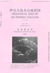
Izu-Oshima Volcano
1: Introduction / Topography of Izu-Oshima
2: Geology of Izu-Oshima Volcano
3: Rocks of Izu-Oshima Volcano
4: Historical outline of Izu-Oshima Volcano after the formation of caldera
5: Activities after 19th century
6: Monitoring / Points to be watched for disaster prevention
7: References
![]() PREV
PREV ![]() NEXT
NEXT
Introduction / Topography of Izu-Oshima
Introduction
Izu-Oshima Volcano is an active volcano about 100 km SSW of Tokyo and east of Izu Peninsula in the NW Pacific Ocean. Many hazardous eruptive activities have occurred in the past. Particularly the fissure eruption of November 1986 was serious leading to evacuation of all the residents of the island for the first time. On the other hand, volcanic glow at the summit, ' Divine Fire ' , has been well known and famed in local songs and one of the tourist attractions of the island.
This geologic map is compiled from the author' s own studies both in the field and in laboratory in addition to those by many predecessors. It should be mentioned that the author owes much for the description of the 1986 eruption from the study by Sakaguchi et al. ( 1987 ). It is hoped that this map is widely utilized for future research, mitigation of hazard, education, and sightseeing.
Topography of Izu-Oshima
Izu-Oshima Island is the northernmost of a festoon of volcanic islands spreading from Marianas to Izu Islands. The highest point of the island is Mt. Miharayama at 764 m a.s.l. but relative height from sea floor reaches about 1,000 m. The outline of the island is oval shape elongated in NNW-SSE direction with length about 15 km and width about 9 km. From the north to the east and on the southwest of the island are developed sea cliffs up to 350 m high ( highest cliff at east coast ). There' s a caldera on the summit with diameter of about 4 km. The caldera wall on the west side is clearly defined, but on the east the wall is obscured being buried by later ejecta. On the south side within the caldera is Mt. Miharayama, a central volcanic cone, with a crater about 800 m across. In the middle of the crater is a vertical pit crater about 300 m across.
![]() PREV
PREV ![]() NEXT
NEXT
