地質画像
蛇行河川
| 項目 | 内容 | ||||
|---|---|---|---|---|---|
| 写真タイトル | 蛇行河川 | ||||
| 画像 | 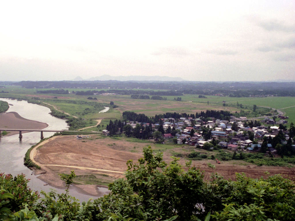 | ||||
| 解説 | 雄物川の蛇行地形です。写真左奥が上流で、手前側へ流れ下っており、写真中央左寄りには三日月湖が残されています。三日月湖外側(右側)の平坦地が旧河床 で、三日月湖内側(左側)の緑地と、手前の砂取り場が現河床に相当します。集落は自然堤防の上に密集してつくられています。 | ||||
| 撮影場所 | 秋田県大仙市強首 | ||||
| ウェブサイト | https://gbank.gsj.jp/geowords/picture/photo/meandering.html | ||||
| @id | https://gbank.gsj.jp/ld/resource/geowords/image/54 | ||||
| 関連用語 |
|