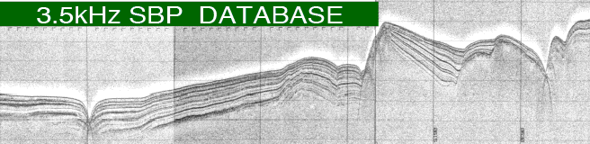
3.5 kHz SBP (Sub-bottom profiler) is one of seismic survey systems to obtain continuous images of geological profiles by transmitting 3.5kHz sound pulse from a research vessel and by receiving reflections from the sea-bottom and sub-bottom. SBP profiles have higher resolution in spite of shallower survey depth below sea-bottom than the air gun seismic profiling system, owing to its higher frequency sound source. Therefore, SBP is useful for investigation of recent sedimentary processes or fault activities.
Positions are indicated under Tokyo Datum for GH01 cruise and before, and WGS84 for GH02 cruise and after.
All copyrights are held by the Geological Survey of Japan, AIST. All material on this database is licensed under the Creative Commons Attribution 2.1 Japan License.
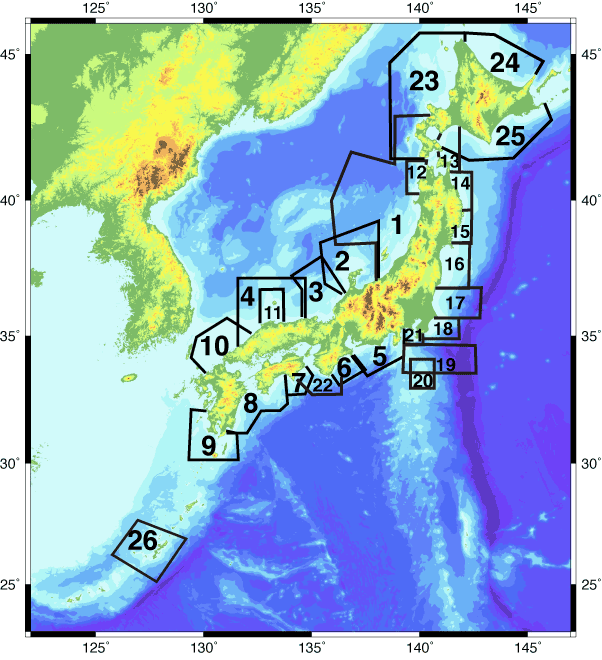
1. Japan Sea off Tohoku (GH892-93)
2. Vicinity of Noto Peninsula (GH882,884)
3. Vicinity of Wakasa Bay (GH872,874)
4. Offshore of Shimane and Tottori (GH862,864)
8. Offshore of Kochi to Miyazaki (GH831,832)
9. South of Kyusyu (GH841,843)
10. North of Kyusyu and Yamaguchi (GH852,854)
12. Nishitsugaru Basin (GH763,773)
13. Off Shimokita Peninsula (GH823)
16. Offshore of Miyagi and Fukushima (GH812,813)
18. East of Boso Peninsula (GH802)
19. East of Izu Islands (GH803S)
20. Northeast of Hachijo-jima Island (GH804)
23. Japan Sea off Hokkaido (GH94,95,96,98,99)
24. Okhotsk Sea off Hokkaido (GH784,00,01)
25. South of Hokkaido (GH02-06)
26. Vicinity of Okinawa-jima Island (GH08-10)
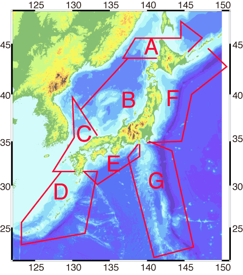
A. Okhotsk Sea and northern Japan Sea (GH773)
C. Western Japan Sea and west of Kyusyu (GH772)
D. Vicinity of Nansei Islands (GH751, 755)
E. Pacific Ocean off southwestern Japan (GH754)
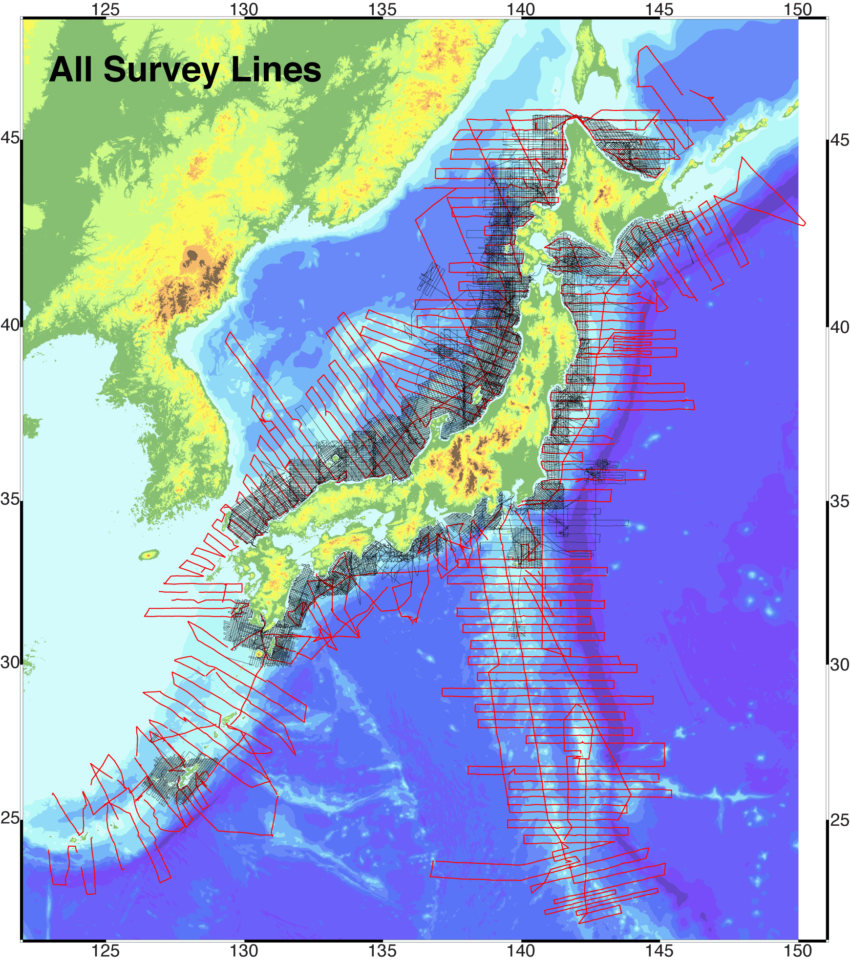
All maps in this database were produced from the digital topographic data "JTOPO30" provided by Marine Information Research Center, Japan Hydrographic Association.