Linked Data: Geological Survey of Japan
JSON
RDF
GSJ LD
Linked Data Service of GSJ
GSJ LD
Literature
Volcano
Specimen
Publication
Image
GSJ LD
>>
Publication
>>
map
>>
tect
>> map1218
GSJ Publication
item
description
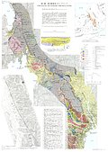
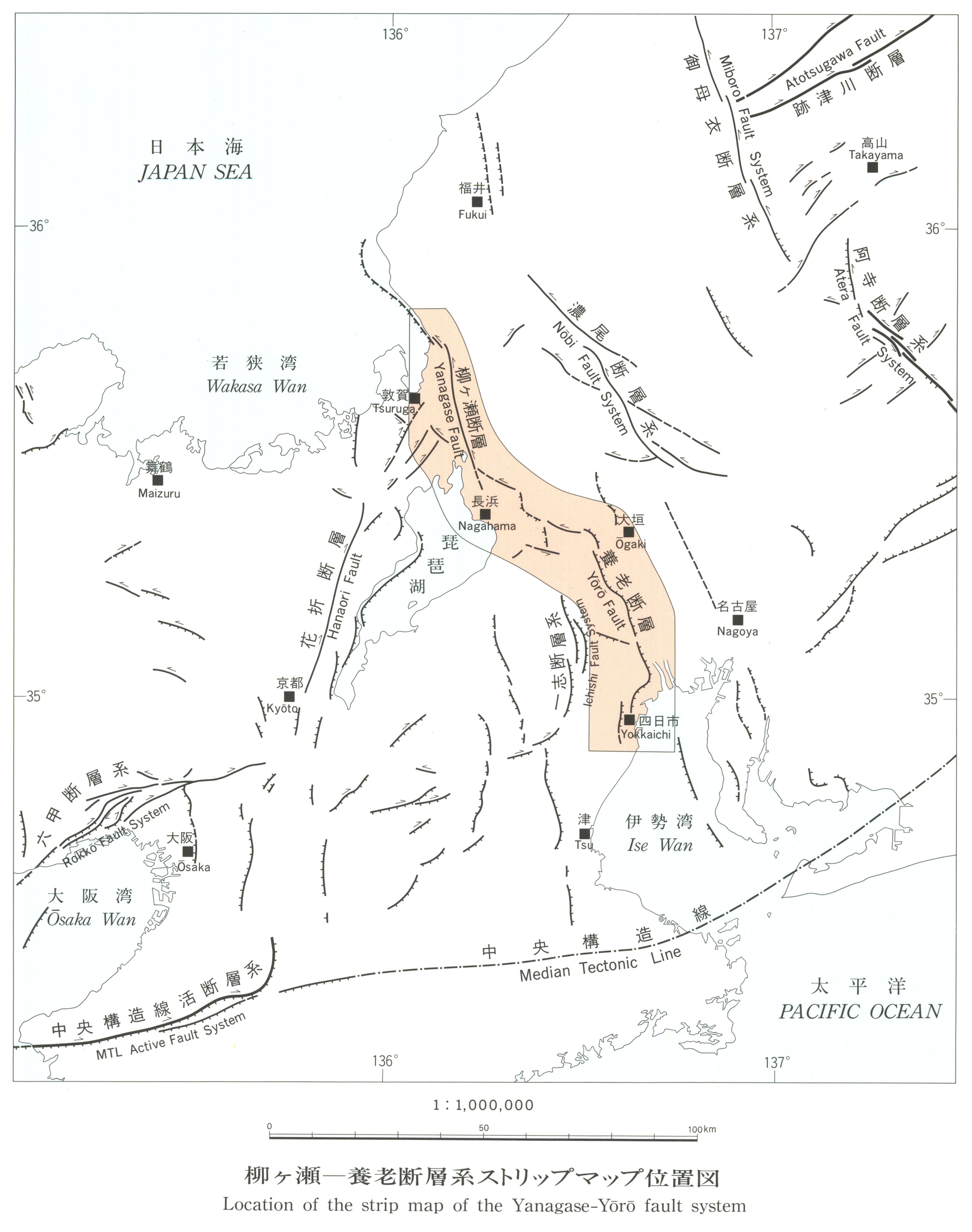
Map name
Tectonic Map 'Strip map of the Yanagase-Yoro fault system' (1994)
Series
Tectonic Map Series
Author
SUGIYAMA Yuichi, AWATA Yasuo, YOSHIOKA Toshikazu
Tribute
10, 1 sheet
Publish year
1994
Publisher
Geological Survey of Japan
@id
https://gbank.gsj.jp/ld/resource/publication/map/tect/map1218
location
Sheet 1
Sheet
Item
Content
TileJSON
https://gbank.gsj.jp/geonavi/maptile/v2/getTileJson/TECT_10.json
Original
Image
Content
https://gbank.gsj.jp/ld/resource/image/map/gsj_map_1218_org_1210.jpg
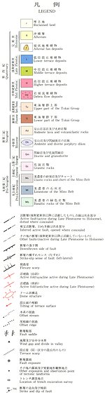
Legend
Image
Content
https://gbank.gsj.jp/ld/resource/image/map/gsj_map_1218_legend_1194.jpg
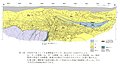
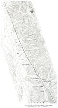
Appended figure
Item
Image
Content
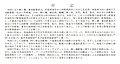
Sketch of the wall of the trench
https://gbank.gsj.jp/ld/resource/image/map/gsj_map_1218_fig_1014.jpg
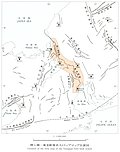
Outcrop and landform of Yanagase fault along
https://gbank.gsj.jp/ld/resource/image/map/gsj_map_1218_fig_1015.jpg
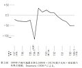
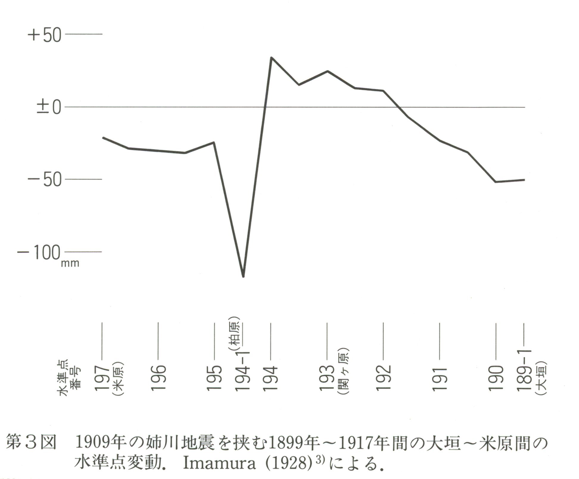
Level point change between Yonehara - Ogaki
https://gbank.gsj.jp/ld/resource/image/map/gsj_map_1218_fig_1016.jpg
location
https://gbank.gsj.jp/ld/resource/image/map/gsj_map_1218_fig_1017.jpg
note
https://gbank.gsj.jp/ld/resource/image/map/gsj_map_1218_fig_1018.jpg
References
https://gbank.gsj.jp/ld/resource/image/map/gsj_map_1218_fig_1019.jpg
sameAs
分類
名称
URI
文献
杉山雄一,粟田泰夫,吉岡敏和 (1994) 柳ヶ瀬-養老断層系ストリップマップ,1:100,000
https://gbank.gsj.jp/ld/resource/geolis/199910537
isPartOf
分類
名称
URI
出版物シリーズ
Geological map
https://gbank.gsj.jp/ld/resource/publication/map/tect
seeAlso
分類
名称
URI
Viewer
GeomapNavi: Tectonic Map 'Strip map of the Yanagase-Yoro fault system' (1994)
https://gbank.gsj.jp/geonavi/geonavi.php?layers=1218