Linked Data: Geological Survey of Japan
JSON
RDF
GSJ LD
Linked Data Service of GSJ
GSJ LD
Literature
Volcano
Specimen
Publication
Image
GSJ LD
>>
Publication
>>
map
>>
hydr
>> map951
GSJ Publication
item
description
Map name
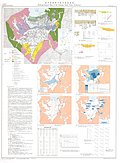
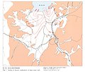
Hydrogeological Map 'Tsuruga Plain, Fukui Prefecture' (1989)
Series
Hydrogeological Maps of Japan
Author
ISHII Takemasa
Tribute
39, 1 sheet
Publish year
1989
Publisher
Geological Survey of Japan
@id
https://gbank.gsj.jp/ld/resource/publication/map/hydr/map951
location
Sheet 1
Sheet
Item
Content
TileJSON
https://gbank.gsj.jp/geonavi/maptile/v2/getTileJson/HY_39.json
Original
Image
Content
https://gbank.gsj.jp/ld/resource/image/map/gsj_map_951_org_956.jpg
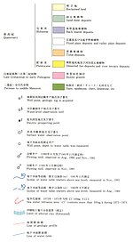
Legend
Image
Content
https://gbank.gsj.jp/ld/resource/image/map/gsj_map_951_legend_1044.jpg
Appended figure
Item
Image
Content
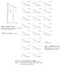
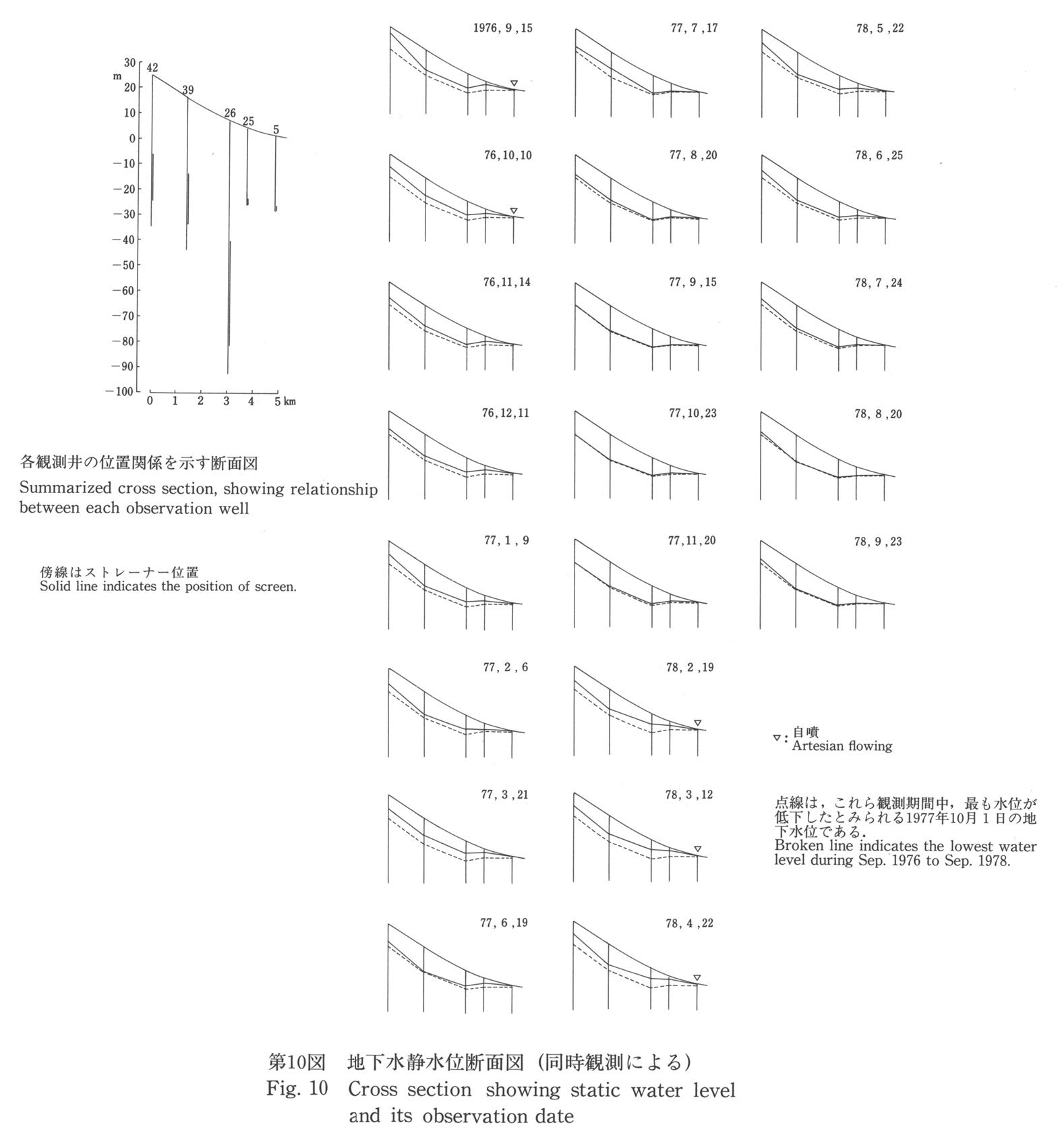
Cross section of static water level and observation date
https://gbank.gsj.jp/ld/resource/image/map/gsj_map_951_fig_747.jpg
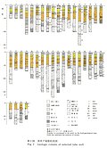
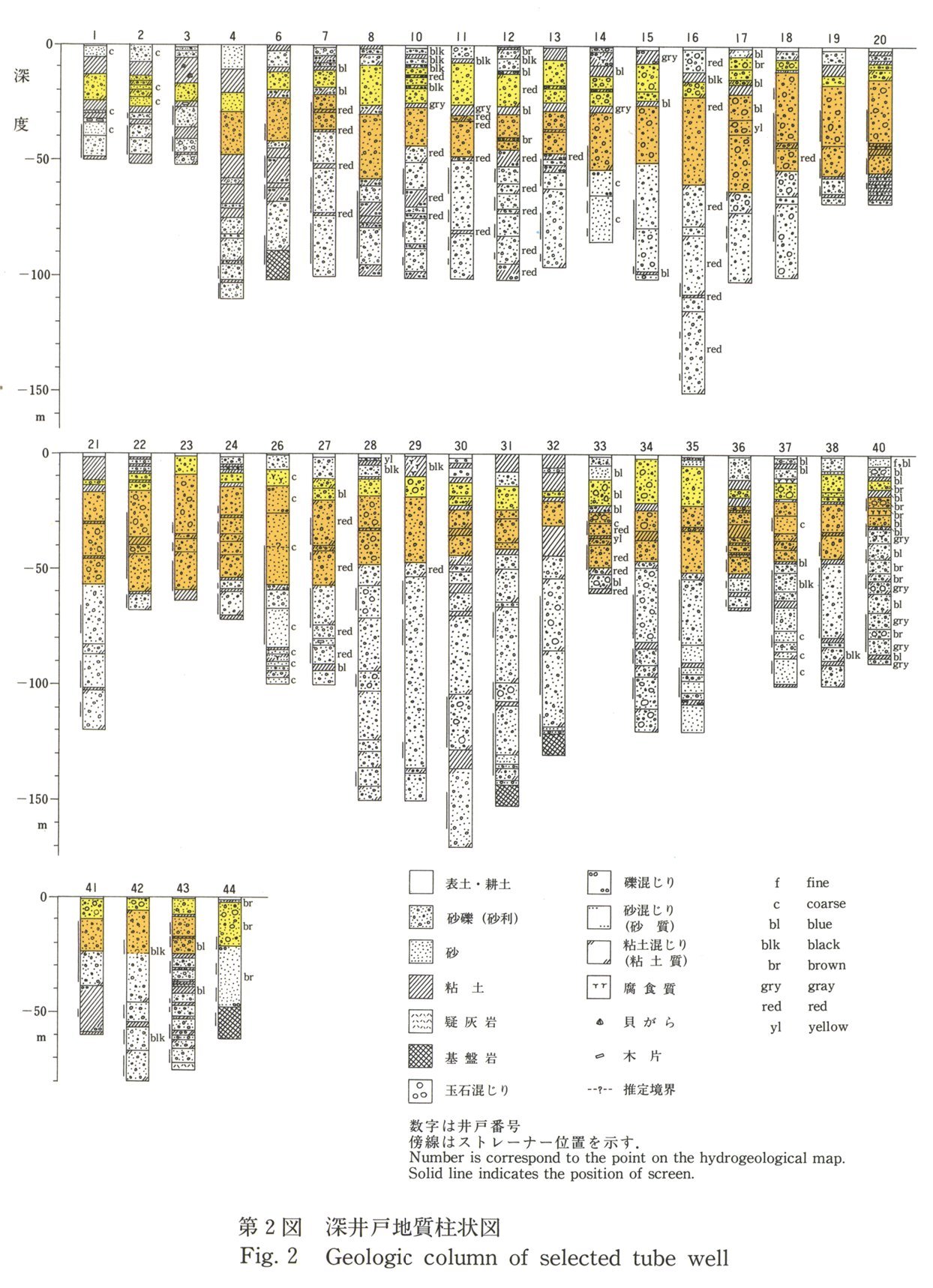
Geological column of selected tube well
https://gbank.gsj.jp/ld/resource/image/map/gsj_map_951_fig_748.jpg
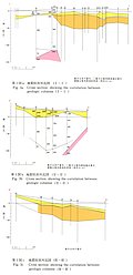
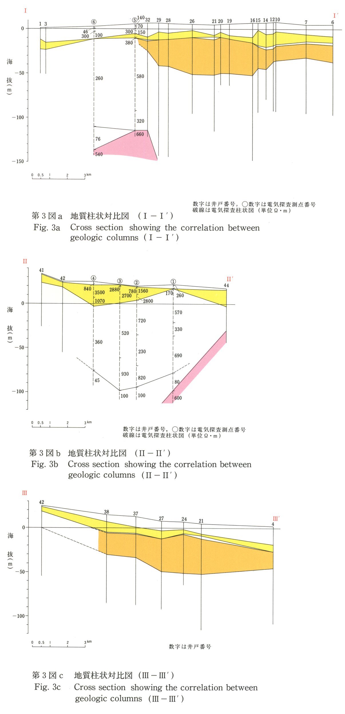
Cross section of correlation between geologic columns
https://gbank.gsj.jp/ld/resource/image/map/gsj_map_951_fig_749.jpg
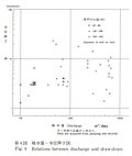
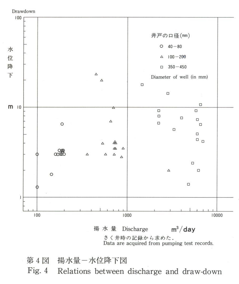
Relations between discharge and draw-down
https://gbank.gsj.jp/ld/resource/image/map/gsj_map_951_fig_750.jpg
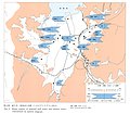
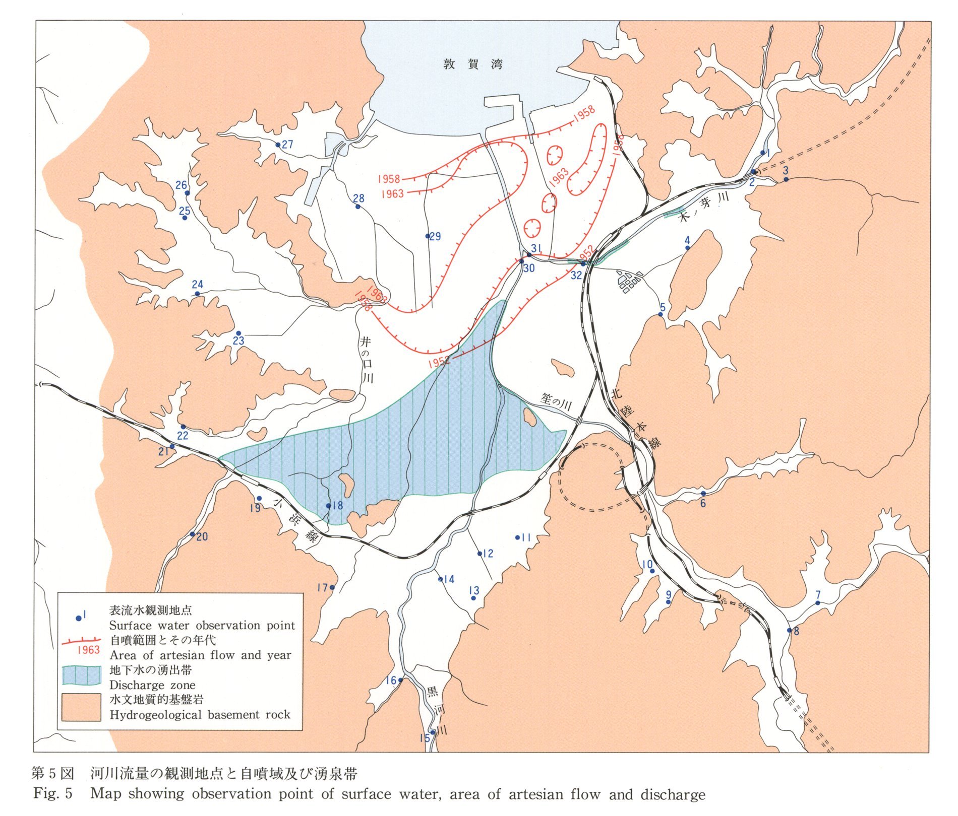
Area of artesian flow and discharge
https://gbank.gsj.jp/ld/resource/image/map/gsj_map_951_fig_751.jpg
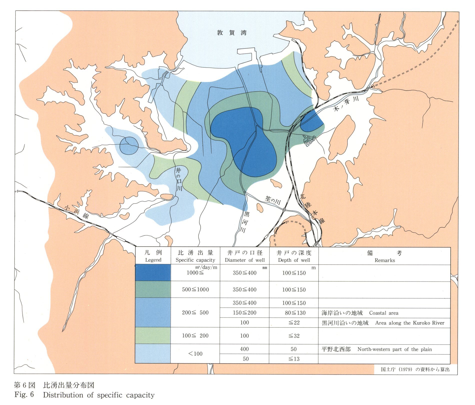
Distribution of specific capacity
https://gbank.gsj.jp/ld/resource/image/map/gsj_map_951_fig_752.jpg
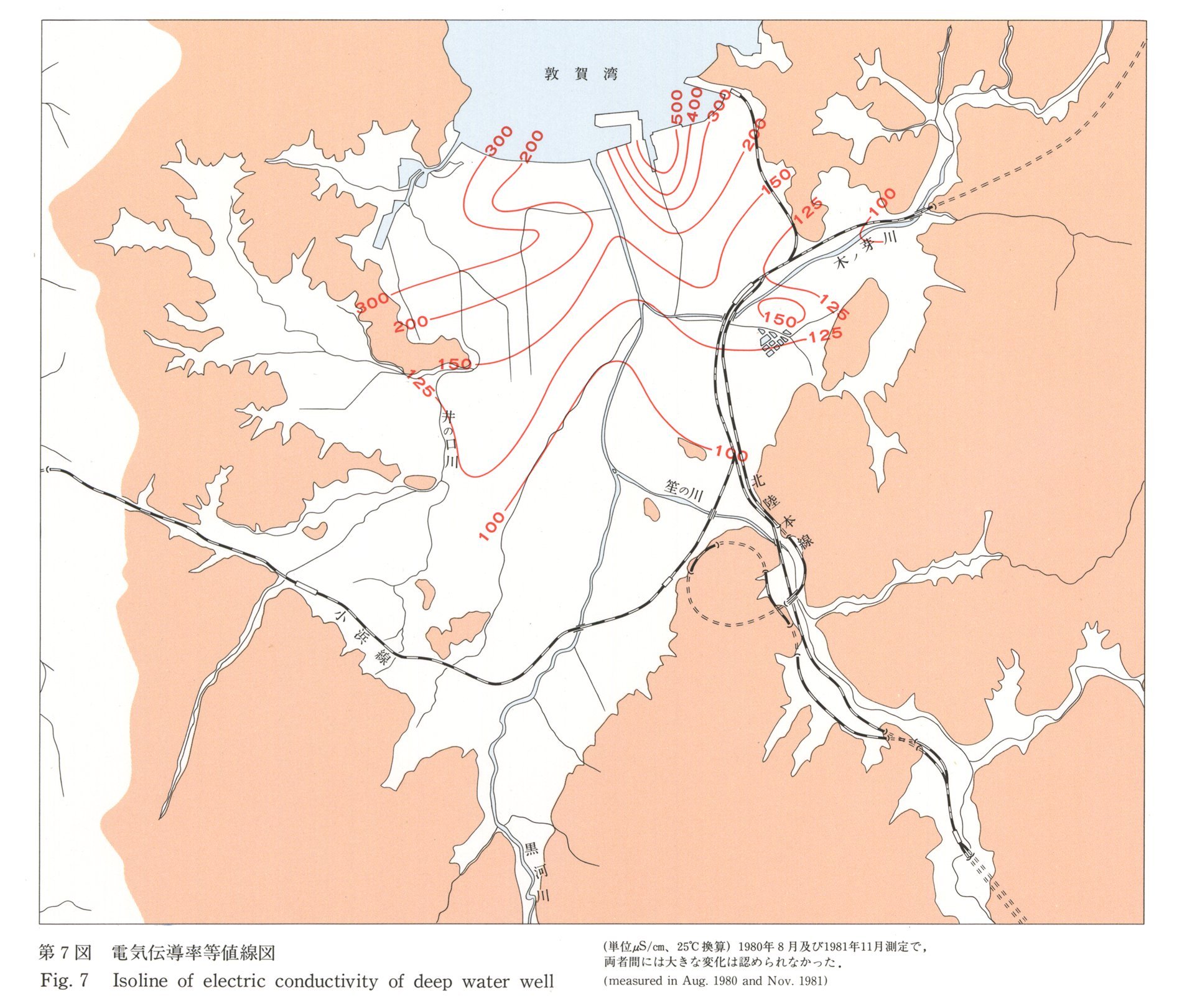
Isoline of electric conductivity of deep water well
https://gbank.gsj.jp/ld/resource/image/map/gsj_map_951_fig_753.jpg
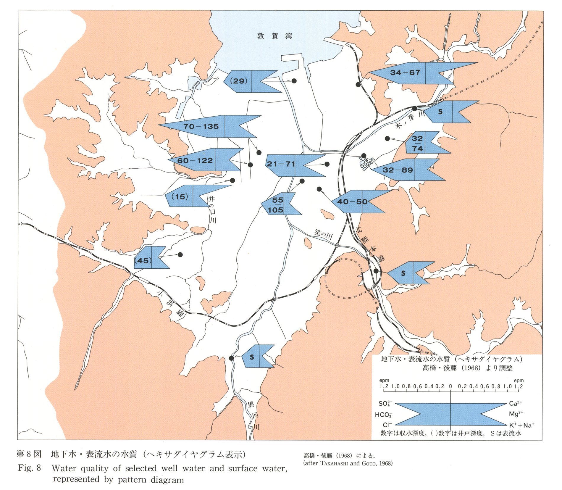
Water quality of selected well water and surface water, represented by pattern diagram
https://gbank.gsj.jp/ld/resource/image/map/gsj_map_951_fig_754.jpg
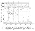
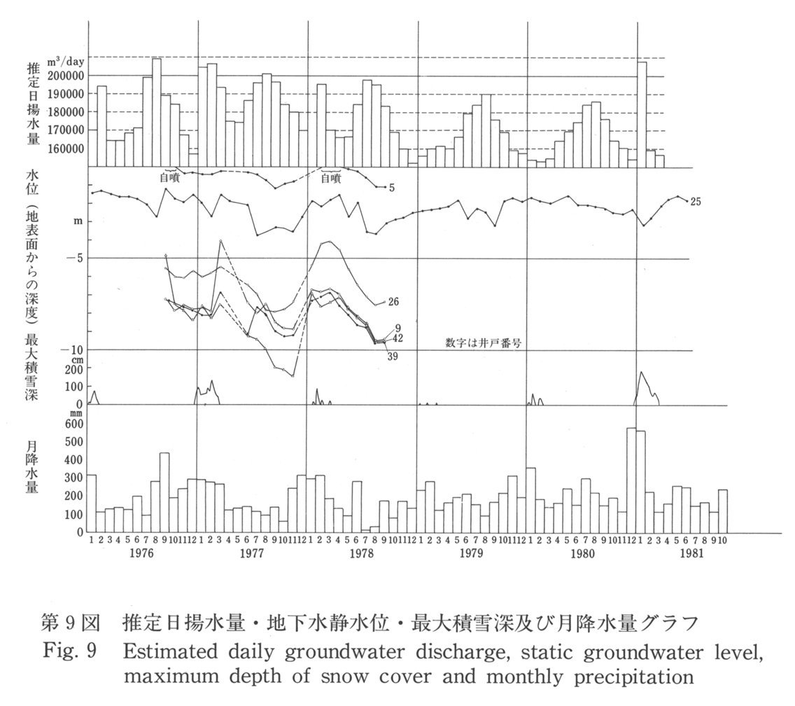
Estimated daily groundwater discharge, ststic groundwater level, maximum depth of snow cover and monthly precipitation
https://gbank.gsj.jp/ld/resource/image/map/gsj_map_951_fig_755.jpg
Description
https://gbank.gsj.jp/ld/resource/image/map/gsj_map_951_fig_756.jpg
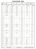
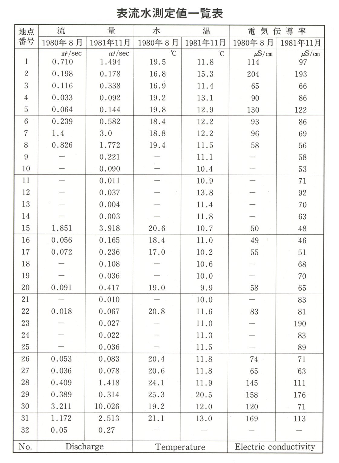
Data table of surface water
https://gbank.gsj.jp/ld/resource/image/map/gsj_map_951_fig_757.jpg
sameAs
分類
名称
URI
文献
石井武政 (1989) 福井県敦賀平野水理地質図,1:25,000
https://gbank.gsj.jp/ld/resource/geolis/198901519
isPartOf
分類
名称
URI
出版物シリーズ
Hydrogeological Maps
https://gbank.gsj.jp/ld/resource/publication/map/hydr
seeAlso
分類
名称
URI
Viewer
GeomapNavi: Hydrogeological Map 'Tsuruga Plain, Fukui Prefecture' (1989)
https://gbank.gsj.jp/geonavi/geonavi.php?layers=951