Linked Data: Geological Survey of Japan
JSON
RDF
GSJ LD
Linked Data Service of GSJ
GSJ LD
Literature
Volcano
Specimen
Publication
Image
GSJ LD
>>
Publication
>>
map
>>
hydr
>> map946
GSJ Publication
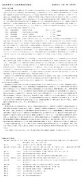
item
description
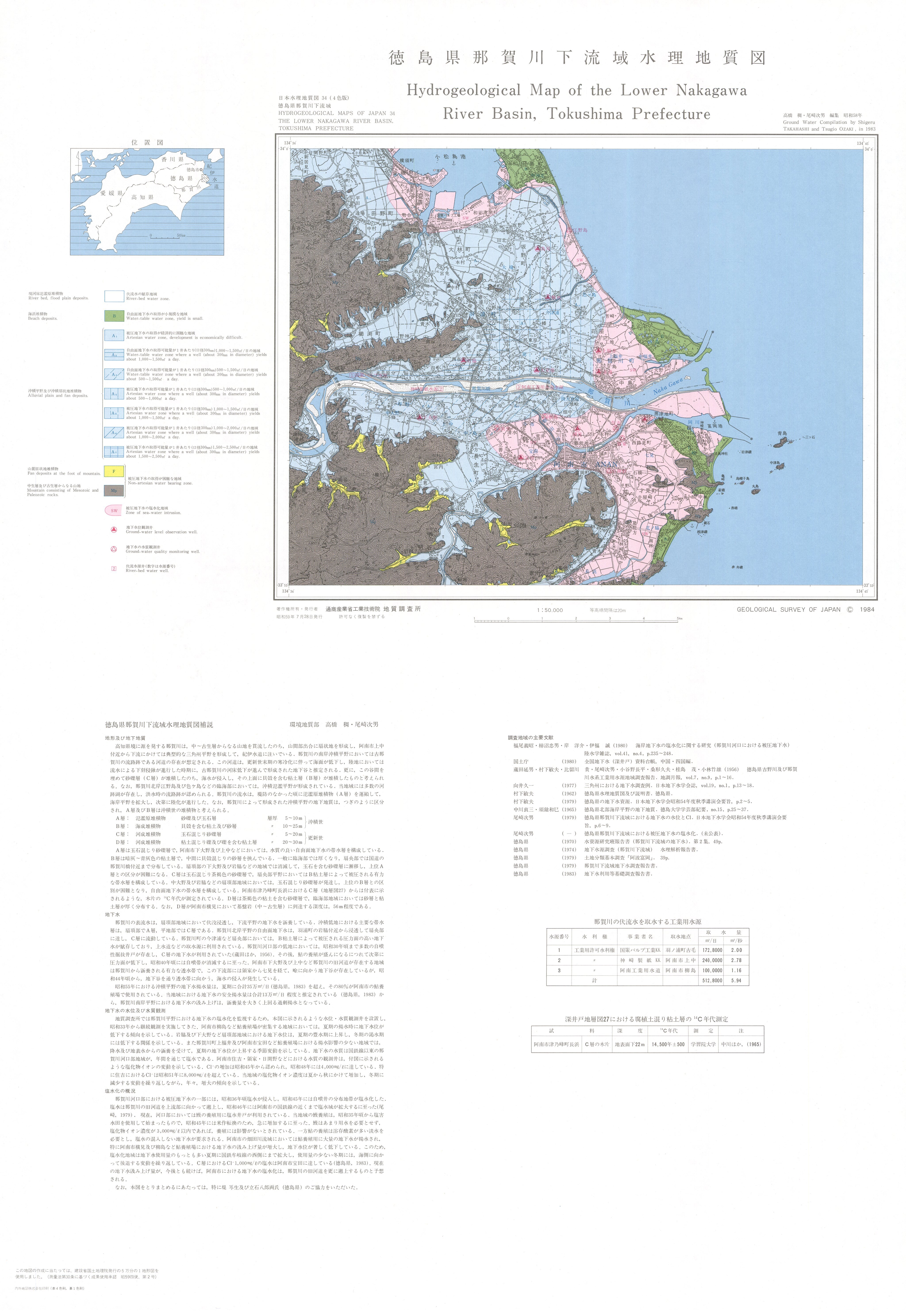
Map name
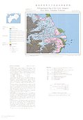
Hydrogeological Map 'Lower Nakagawa River Basin, Tokushima Prefecture' (1984)
Series
Hydrogeological Maps of Japan
Author
TAKAHASHI Shigeru, OZAKI Tsugio
Tribute
34, 1 sheet
Publish year
1984
Publisher
Geological Survey of Japan
@id
https://gbank.gsj.jp/ld/resource/publication/map/hydr/map946
location
Sheet 1
Sheet
Item
Content
TileJSON
https://gbank.gsj.jp/geonavi/maptile/v2/getTileJson/HY_34.json
Original
Image
Content
https://gbank.gsj.jp/ld/resource/image/map/gsj_map_946_org_951.jpg
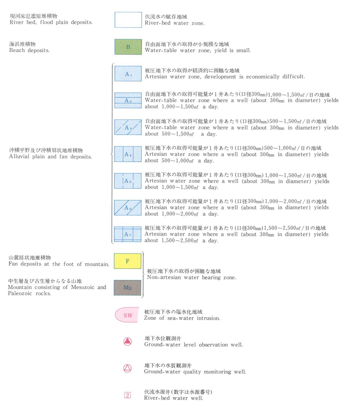
Legend
Image
Content
https://gbank.gsj.jp/ld/resource/image/map/gsj_map_946_legend_1039.jpg
Appended figure
Item
Image
Content
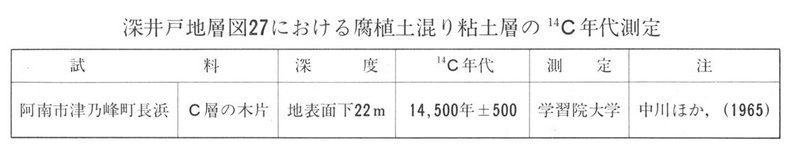
14C age of the clay formation with humus (K)
https://gbank.gsj.jp/ld/resource/image/map/gsj_map_946_fig_726.jpg
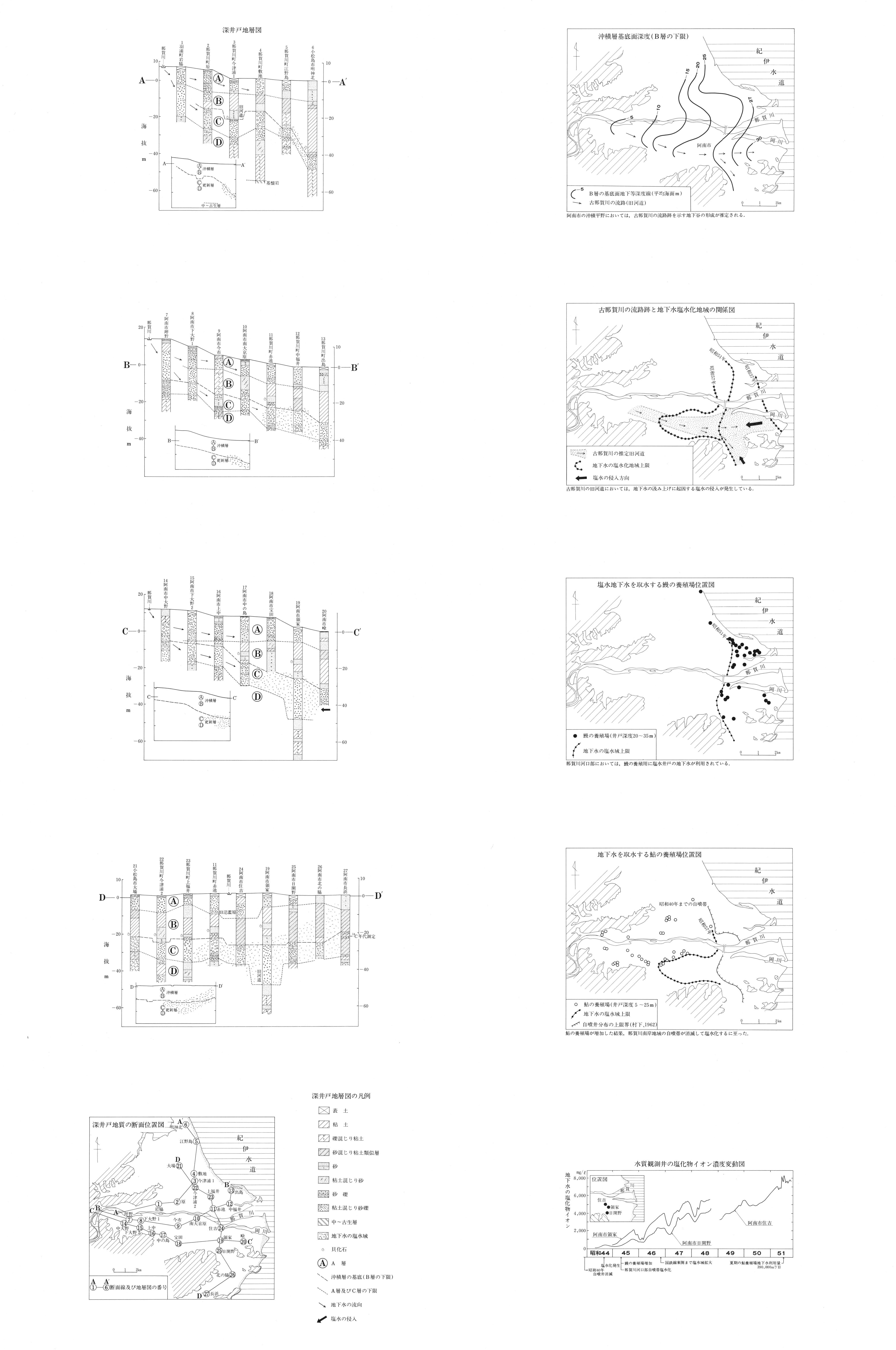
Supplementary explanation
https://gbank.gsj.jp/ld/resource/image/map/gsj_map_946_fig_727.jpg
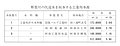
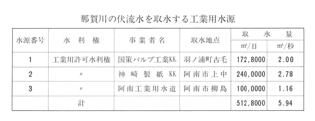
Source of water for industrial use
https://gbank.gsj.jp/ld/resource/image/map/gsj_map_946_fig_728.jpg
Figures
https://gbank.gsj.jp/ld/resource/image/map/gsj_map_946_fig_1305.jpg
sameAs
分類
名称
URI
文献
高橋稠,尾崎次男 (1984) 徳島県那賀川下流域水理地質図,1:50,000
https://gbank.gsj.jp/ld/resource/geolis/198403488
isPartOf
分類
名称
URI
出版物シリーズ
Hydrogeological Maps
https://gbank.gsj.jp/ld/resource/publication/map/hydr
seeAlso
分類
名称
URI
Viewer
GeomapNavi: Hydrogeological Map 'Lower Nakagawa River Basin, Tokushima Prefecture' (1984)
https://gbank.gsj.jp/geonavi/geonavi.php?layers=946