Linked Data: Geological Survey of Japan
JSON
RDF
GSJ LD
Linked Data Service of GSJ
GSJ LD
Literature
Volcano
Specimen
Publication
Image
GSJ LD
>>
Publication
>>
map
>>
hydr
>> map933
GSJ Publication
item
description
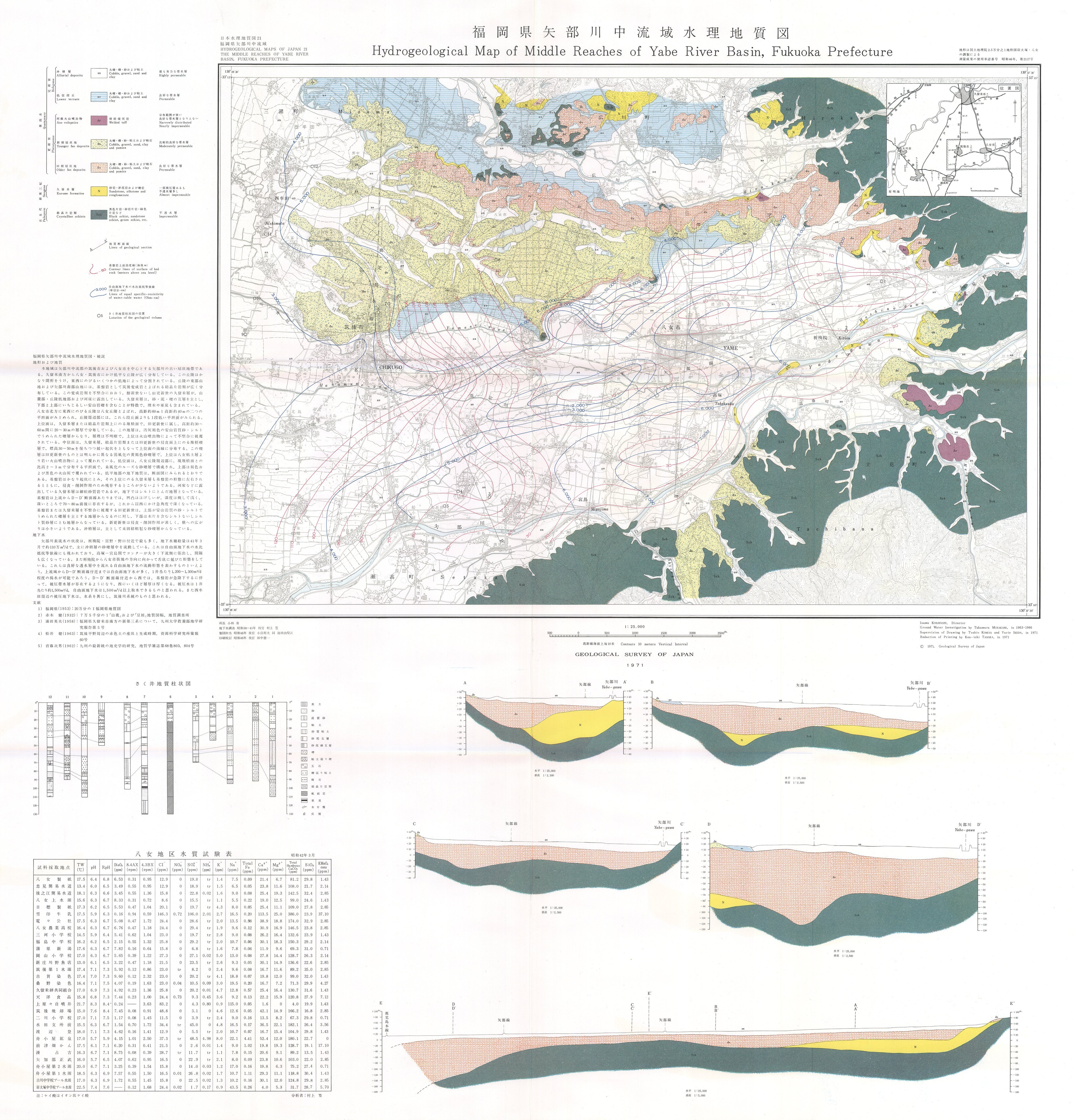
Map name
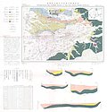
Hydrogeological Map 'Middle Reaches of Yabe River Basin, Fukuoka Prefecture' (1971)
Series
Hydrogeological Maps of Japan
Author
MURAKAMI Takamura
Tribute
21, 1 sheet
Publish year
1971
Publisher
Geological Survey of Japan
@id
https://gbank.gsj.jp/ld/resource/publication/map/hydr/map933
location
Sheet 1
Sheet
Item
Content
TileJSON
https://gbank.gsj.jp/geonavi/maptile/v2/getTileJson/HY_21.json
Original
Image
Content
https://gbank.gsj.jp/ld/resource/image/map/gsj_map_933_org_938.jpg
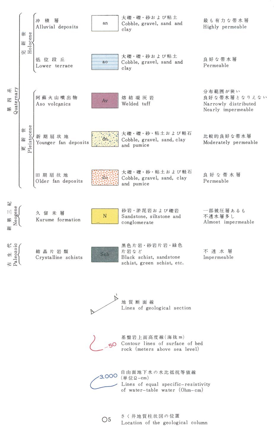
Legend
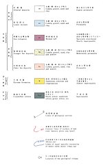
Image
Content
https://gbank.gsj.jp/ld/resource/image/map/gsj_map_933_legend_1026.jpg
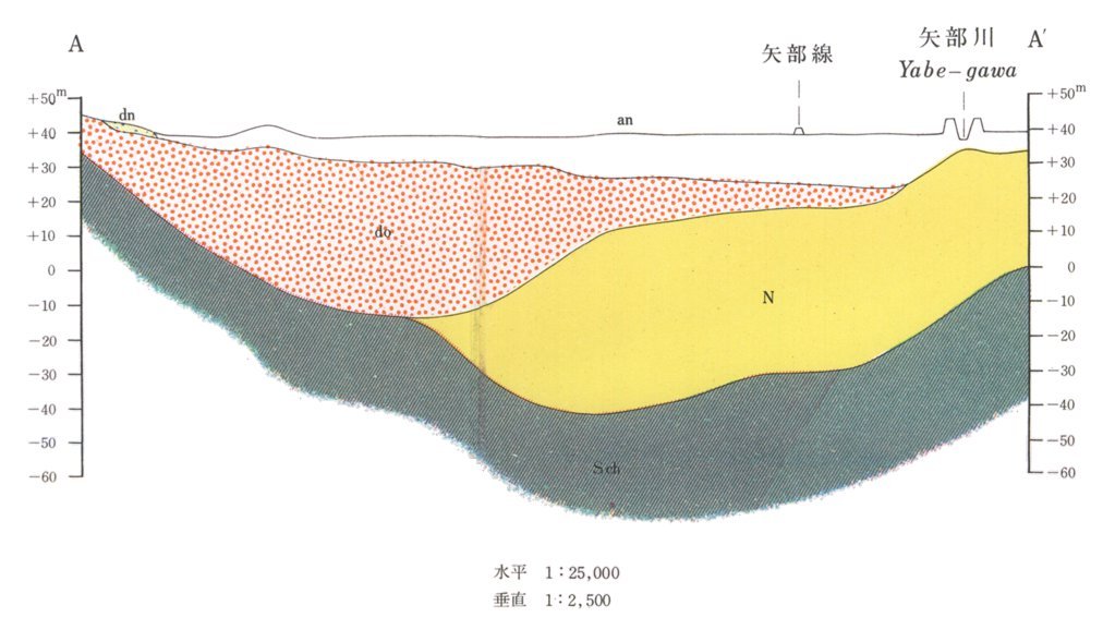
Section
Item
Image
Content
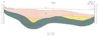
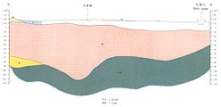
Section: AA'
位置(GeoJSON)
https://gbank.gsj.jp/ld/resource/image/map/gsj_map_933_section_1877.jpg
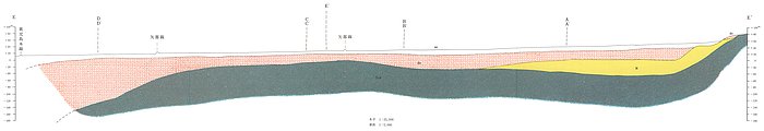
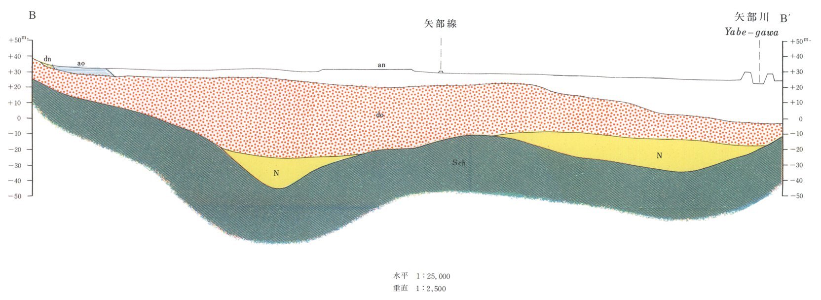
Section: BB'
位置(GeoJSON)
https://gbank.gsj.jp/ld/resource/image/map/gsj_map_933_section_1878.jpg
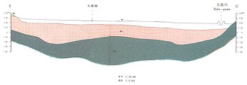
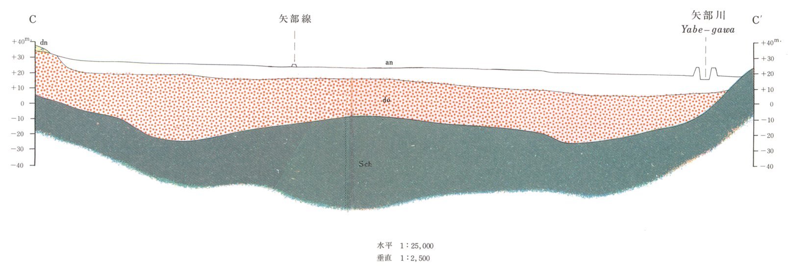
Section: CC'
位置(GeoJSON)
https://gbank.gsj.jp/ld/resource/image/map/gsj_map_933_section_1879.jpg
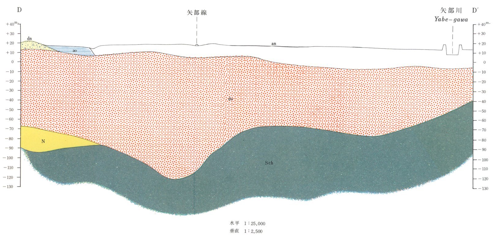
Section: DD'
位置(GeoJSON)
https://gbank.gsj.jp/ld/resource/image/map/gsj_map_933_section_1880.jpg
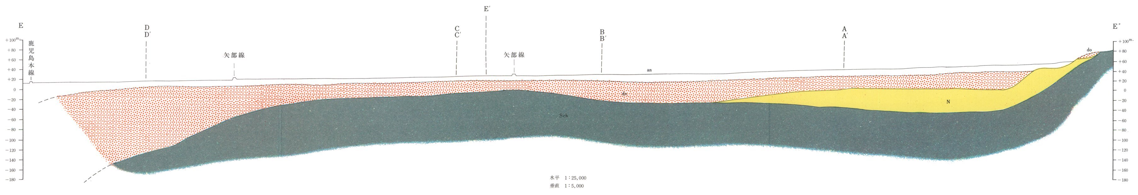
Section: EE'E''
位置(GeoJSON)
https://gbank.gsj.jp/ld/resource/image/map/gsj_map_933_section_1881.jpg
Appended figure
Item
Image
Content
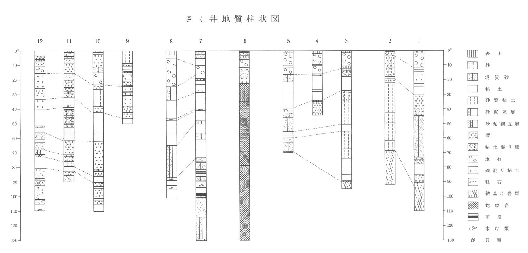
Geological column
https://gbank.gsj.jp/ld/resource/image/map/gsj_map_933_fig_665.jpg
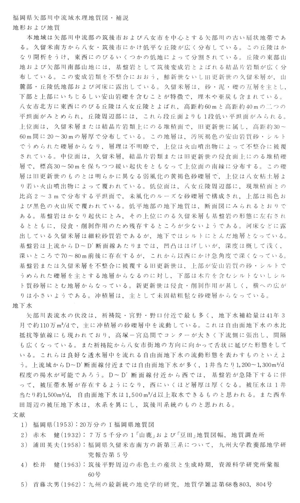
Supplementary explanation
https://gbank.gsj.jp/ld/resource/image/map/gsj_map_933_fig_666.jpg
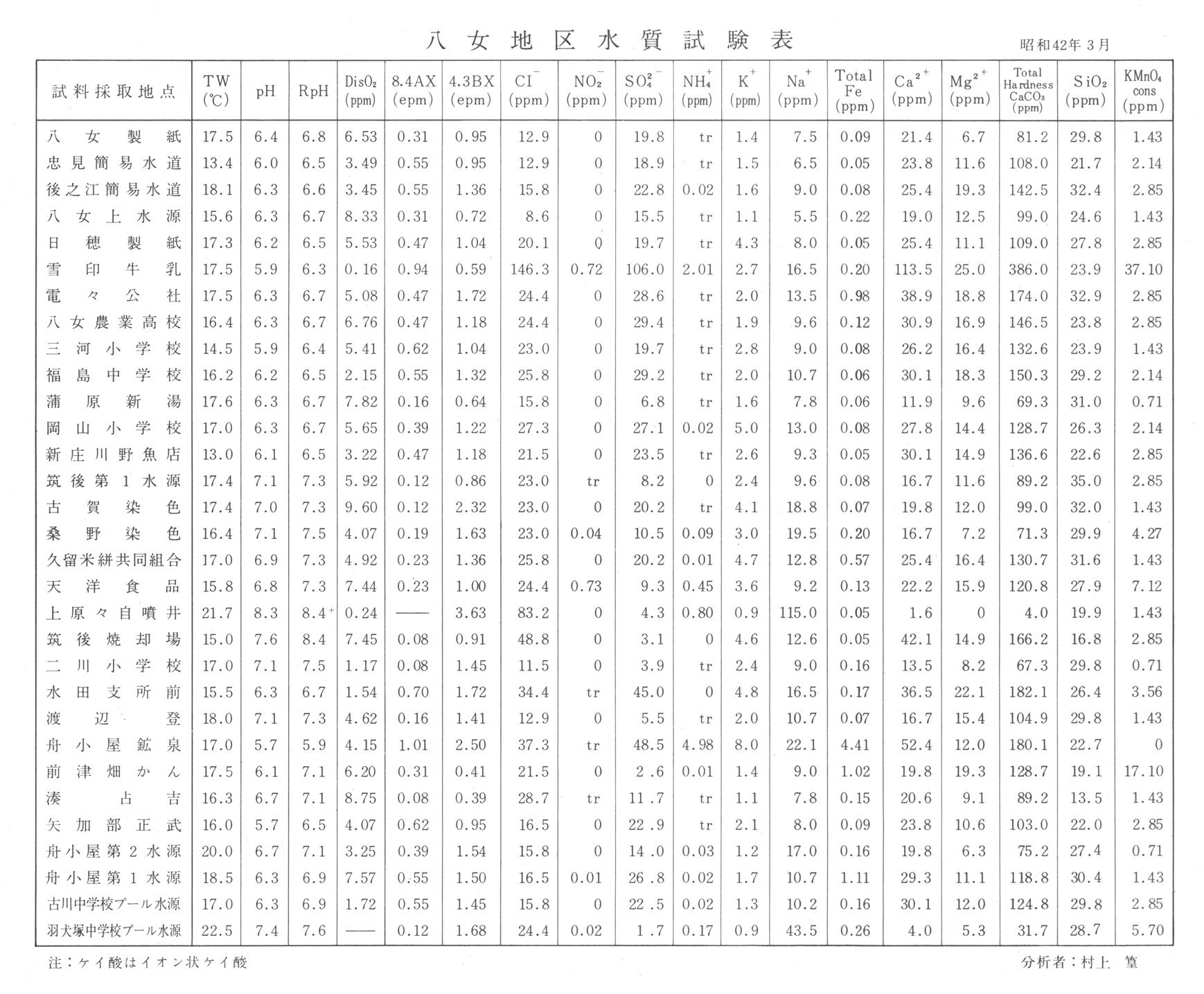
Water quality
https://gbank.gsj.jp/ld/resource/image/map/gsj_map_933_fig_667.jpg
sameAs
分類
名称
URI
文献
村上篁 (1971) 福岡県矢部川中流域水理地質図,1:25,000
https://gbank.gsj.jp/ld/resource/geolis/99904923
isPartOf
分類
名称
URI
出版物シリーズ
Hydrogeological Maps
https://gbank.gsj.jp/ld/resource/publication/map/hydr
seeAlso
分類
名称
URI
Viewer
GeomapNavi: Hydrogeological Map 'Middle Reaches of Yabe River Basin, Fukuoka Prefecture' (1971)
https://gbank.gsj.jp/geonavi/geonavi.php?layers=933
