Linked Data: Geological Survey of Japan
JSON
RDF
GSJ LD
Linked Data Service of GSJ
GSJ LD
Literature
Volcano
Specimen
Publication
Image
GSJ LD
>>
Publication
>>
map
>>
hydr
>> map925
GSJ Publication
item
description
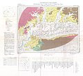
Map name
Hydrogeological Map 'Middle Reaches of Chikugo River Basin, Saga & Fukuoka Prefecture' (1967)
Series
Hydrogeological Maps of Japan
Author
TAKAHASHI Shigeru, GOTO Hayaji
Tribute
13, 1 sheet
Publish year
1967
Publisher
Geological Survey of Japan
@id
https://gbank.gsj.jp/ld/resource/publication/map/hydr/map925
location
Sheet 1
Sheet
Item
Content
TileJSON
https://gbank.gsj.jp/geonavi/maptile/v2/getTileJson/HY_13.json
Original
Image
Content
https://gbank.gsj.jp/ld/resource/image/map/gsj_map_925_org_929.jpg
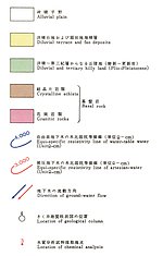
Legend
Image
Content
https://gbank.gsj.jp/ld/resource/image/map/gsj_map_925_legend_1018.jpg
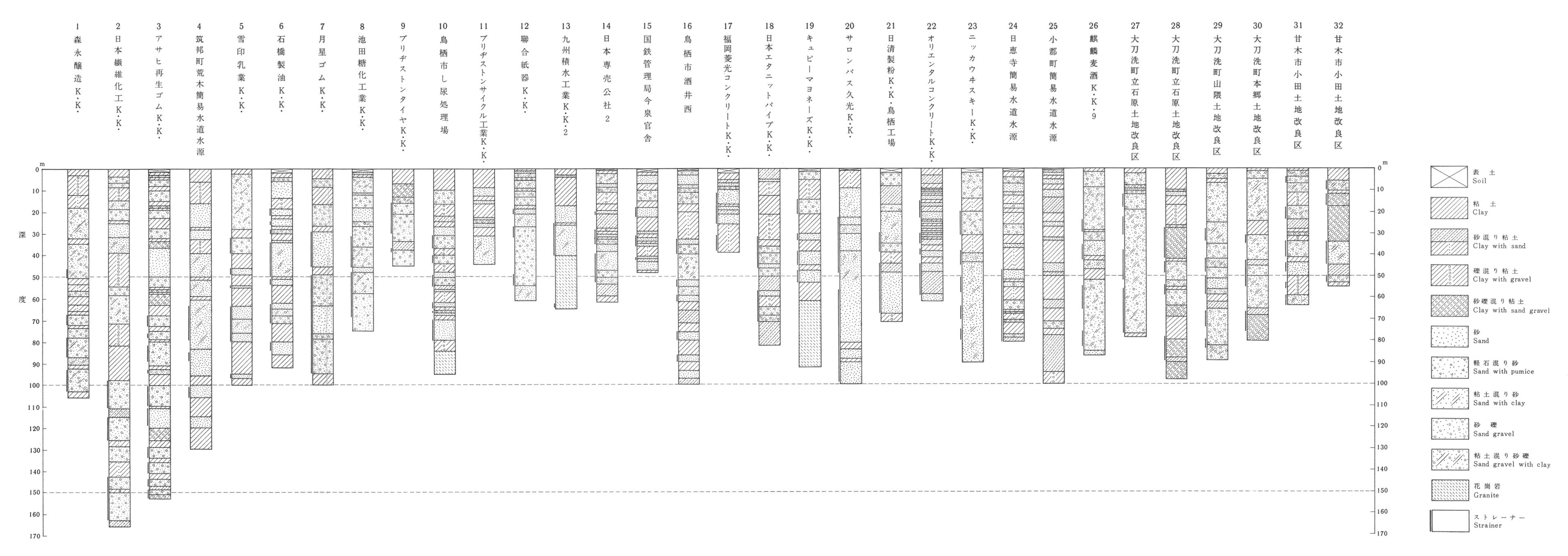
Appended figure
Item
Image
Content
Geological column
https://gbank.gsj.jp/ld/resource/image/map/gsj_map_925_fig_636.jpg
Description
https://gbank.gsj.jp/ld/resource/image/map/gsj_map_925_fig_637.jpg
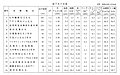
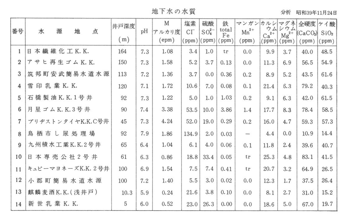
Water quality
https://gbank.gsj.jp/ld/resource/image/map/gsj_map_925_fig_638.jpg
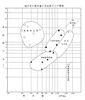
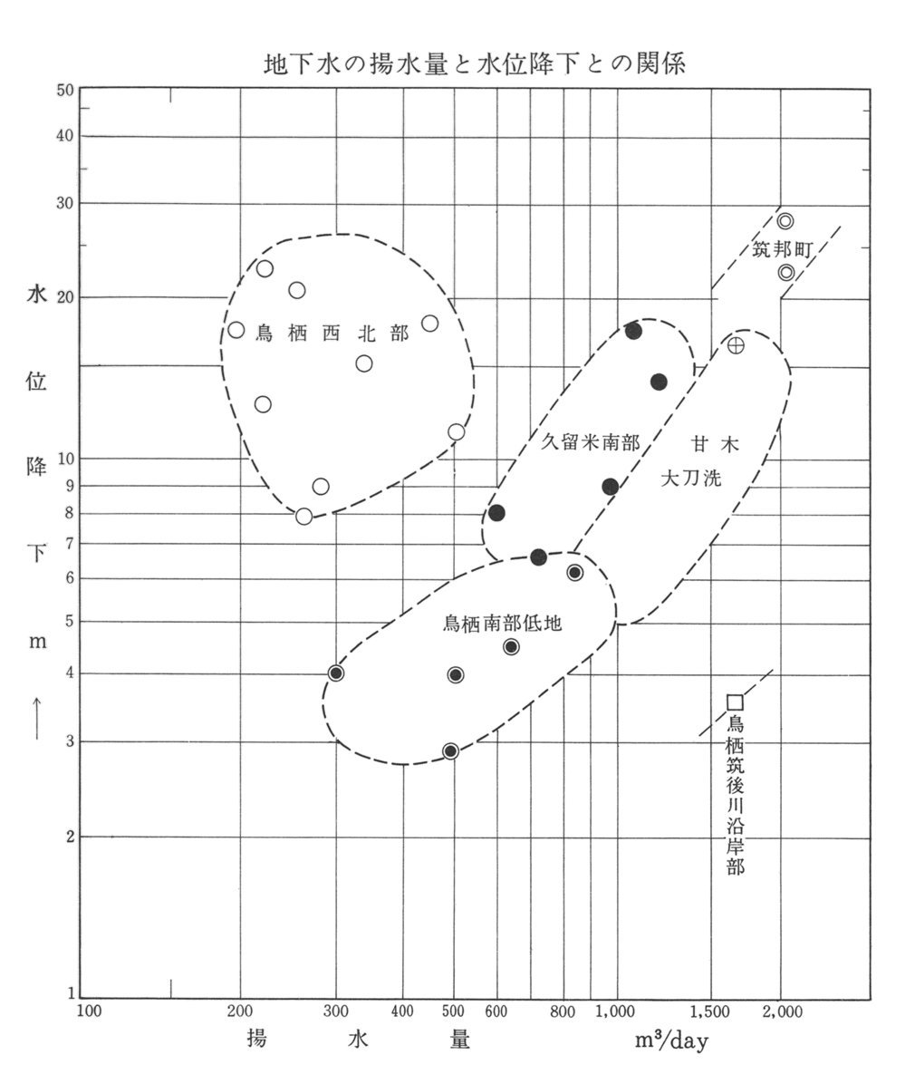
Pump discharge
https://gbank.gsj.jp/ld/resource/image/map/gsj_map_925_fig_639.jpg
sameAs
分類
名称
URI
文献
高橋稠,後藤隼次 (1967) 佐賀・福岡県筑後川中流域水理地質図,1:50,000
https://gbank.gsj.jp/ld/resource/geolis/99904914
isPartOf
分類
名称
URI
出版物シリーズ
Hydrogeological Maps
https://gbank.gsj.jp/ld/resource/publication/map/hydr
seeAlso
分類
名称
URI
Viewer
GeomapNavi: Hydrogeological Map 'Middle Reaches of Chikugo River Basin, Saga & Fukuoka Prefecture' (1967)
https://gbank.gsj.jp/geonavi/geonavi.php?layers=925