Linked Data: Geological Survey of Japan
JSON
RDF
GSJ LD
Linked Data Service of GSJ
GSJ LD
Literature
Volcano
Specimen
Publication
Image
GSJ LD
>>
Publication
>>
map
>>
g200
>> map992
GSJ Publication
item
description
Map name
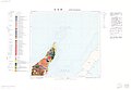
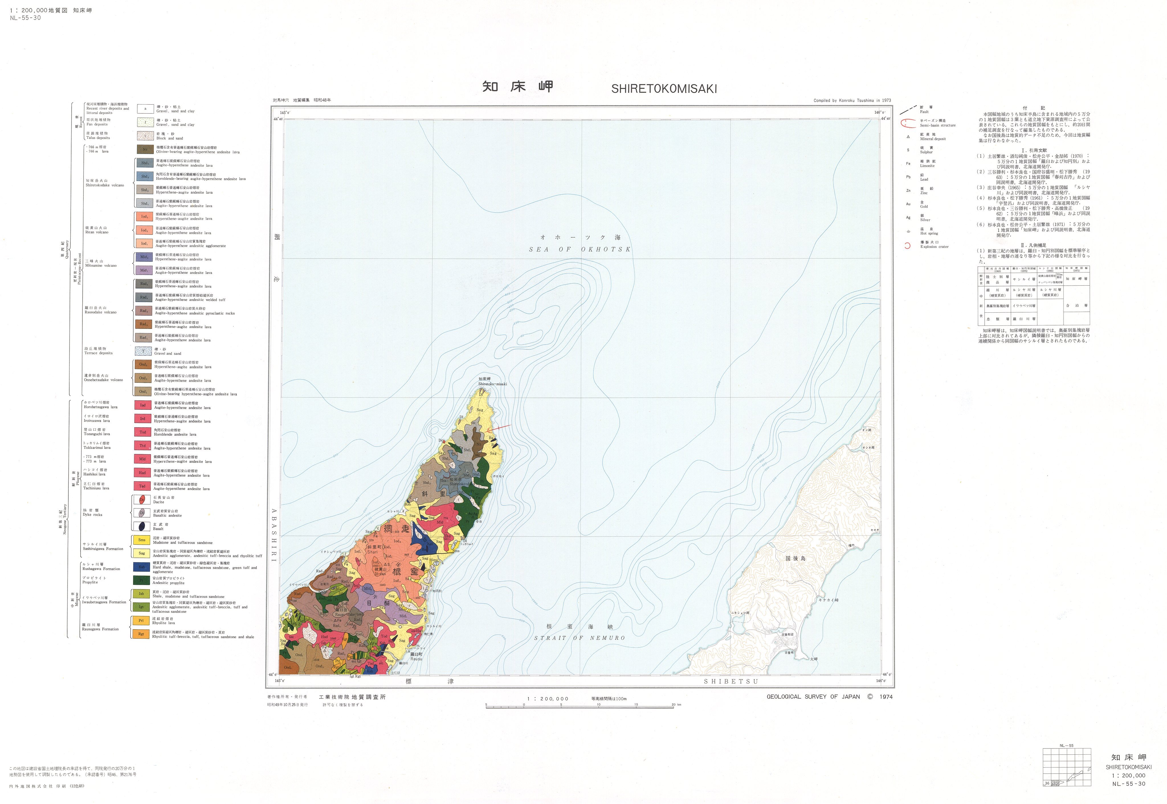
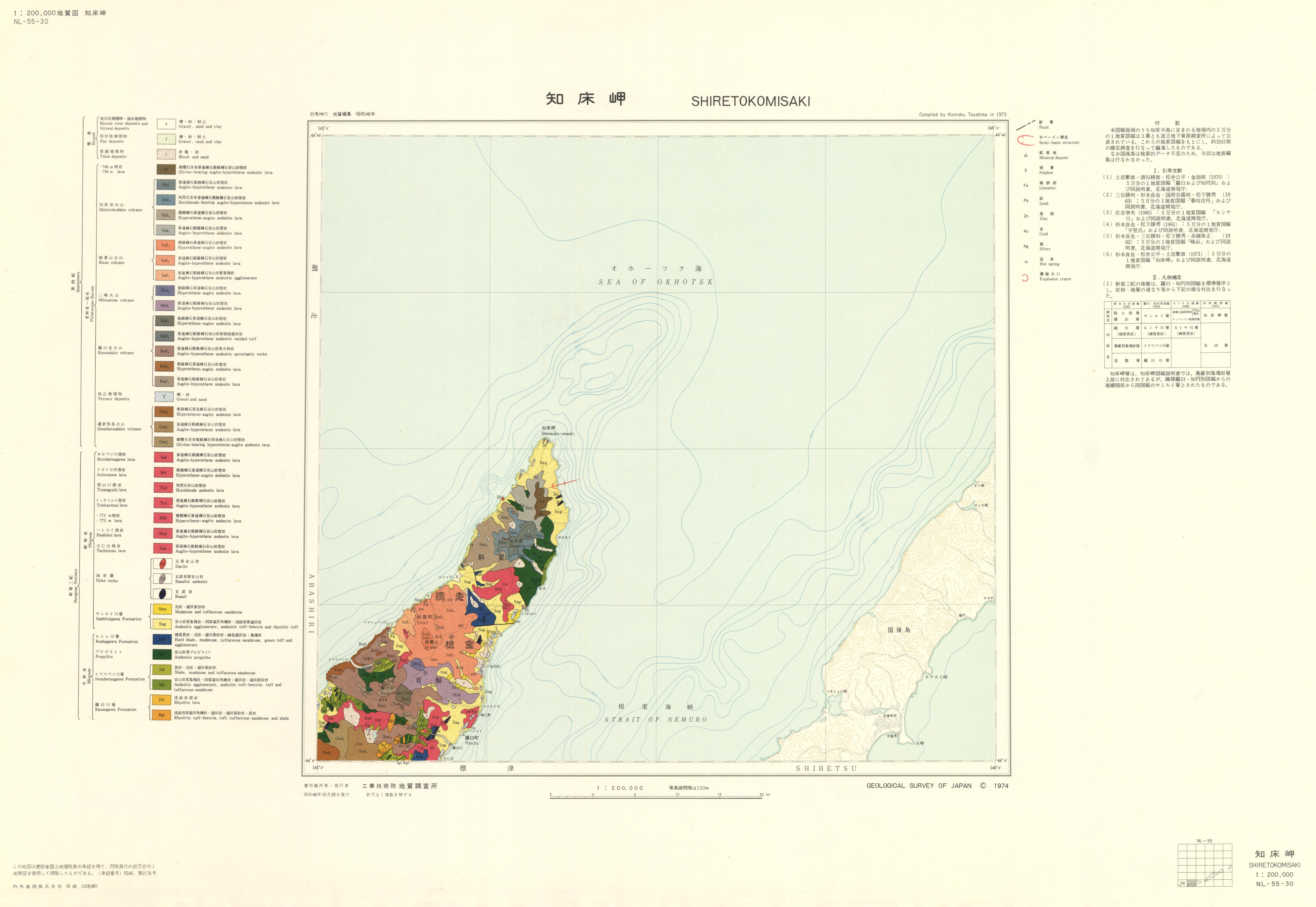
1:200K GeoMap 'Shiretokomisaki' (1974)
Series
Geological Map, 1:200,000
Author
TSUSHIMA Konroku
Tribute
NL-55-30, 1 sheet
Publish year
1974
Publisher
Geological Survey of Japan
@id
https://gbank.gsj.jp/ld/resource/publication/map/g200/map992
location
Sheet 1
Sheet
Item
Content
TileJSON
https://gbank.gsj.jp/geonavi/maptile/v2/getTileJson/G200_NL55_30shiretokomisaki.json
Original
Image
Content
https://gbank.gsj.jp/ld/resource/image/map/gsj_map_992_org_992.jpg
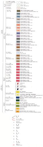
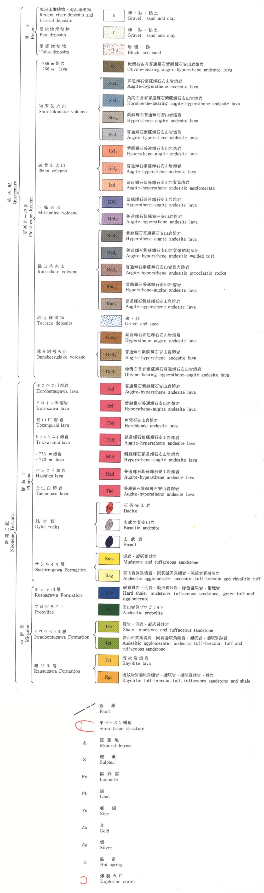
Legend
Image
Content
https://gbank.gsj.jp/ld/resource/image/map/gsj_map_992_legend_120.jpg
Appended figure
Item
Image
Content
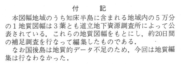
Note
https://gbank.gsj.jp/ld/resource/image/map/gsj_map_992_fig_421.jpg
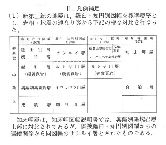
Supplement of legend
https://gbank.gsj.jp/ld/resource/image/map/gsj_map_992_fig_422.jpg
References
https://gbank.gsj.jp/ld/resource/image/map/gsj_map_992_fig_423.jpg
sameAs
分類
名称
URI
文献
対馬坤六 (1974) 20万分の1地質図幅「知床岬」
https://gbank.gsj.jp/ld/resource/geolis/99905012
isPartOf
分類
名称
URI
出版物シリーズ
Geological Map 1:200,000
https://gbank.gsj.jp/ld/resource/publication/map/g200
hasPart
分類
名称
URI
鉱床・鉱徴地
要素グループ:鉱床位置情報
https://gbank.gsj.jp/ld/resource/mine/group/gsjmap992
seeAlso
分類
名称
URI
Viewer
GeomapNavi: 1:200K GeoMap 'Shiretokomisaki' (1974)
https://gbank.gsj.jp/geonavi/geonavi.php?layers=992
downloadData
形式
名称
URI
JPEG
https://www.gsj.jp/data/200KGM/JPG/GSJ_MAP_G200_NL5530_1974_200dpi.jpg
GeoTiff/KML
https://www.gsj.jp/data/200KGM/GTF/GSJ_MAP_G200_NL5530_1974.zip
