Linked Data: Geological Survey of Japan
JSON
RDF
GSJ LD
Linked Data Service of GSJ
GSJ LD
Literature
Volcano
Specimen
Publication
Image
GSJ LD
>>
Publication
>>
map
>>
g200
>> map1179
GSJ Publication
item
description
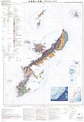
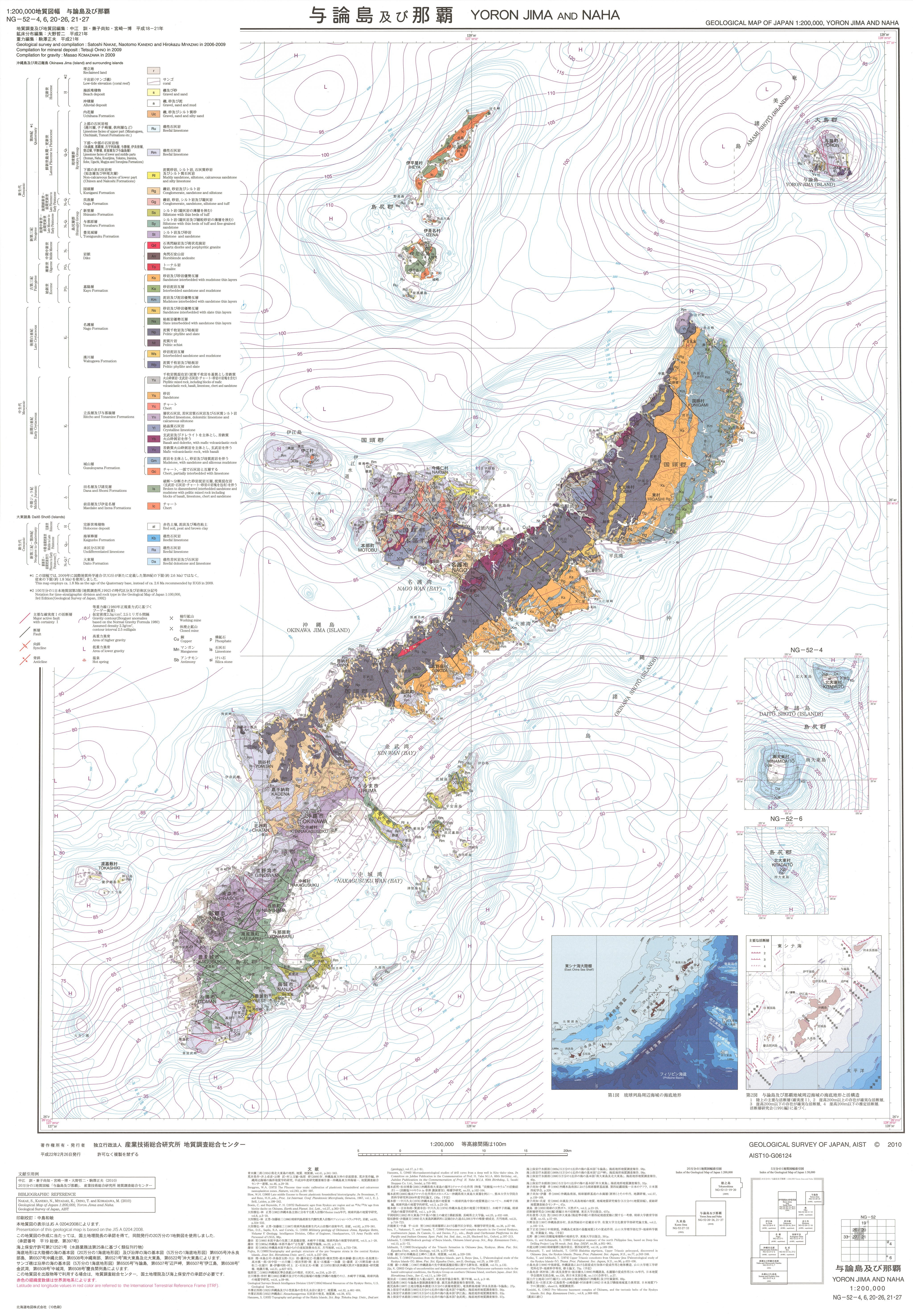
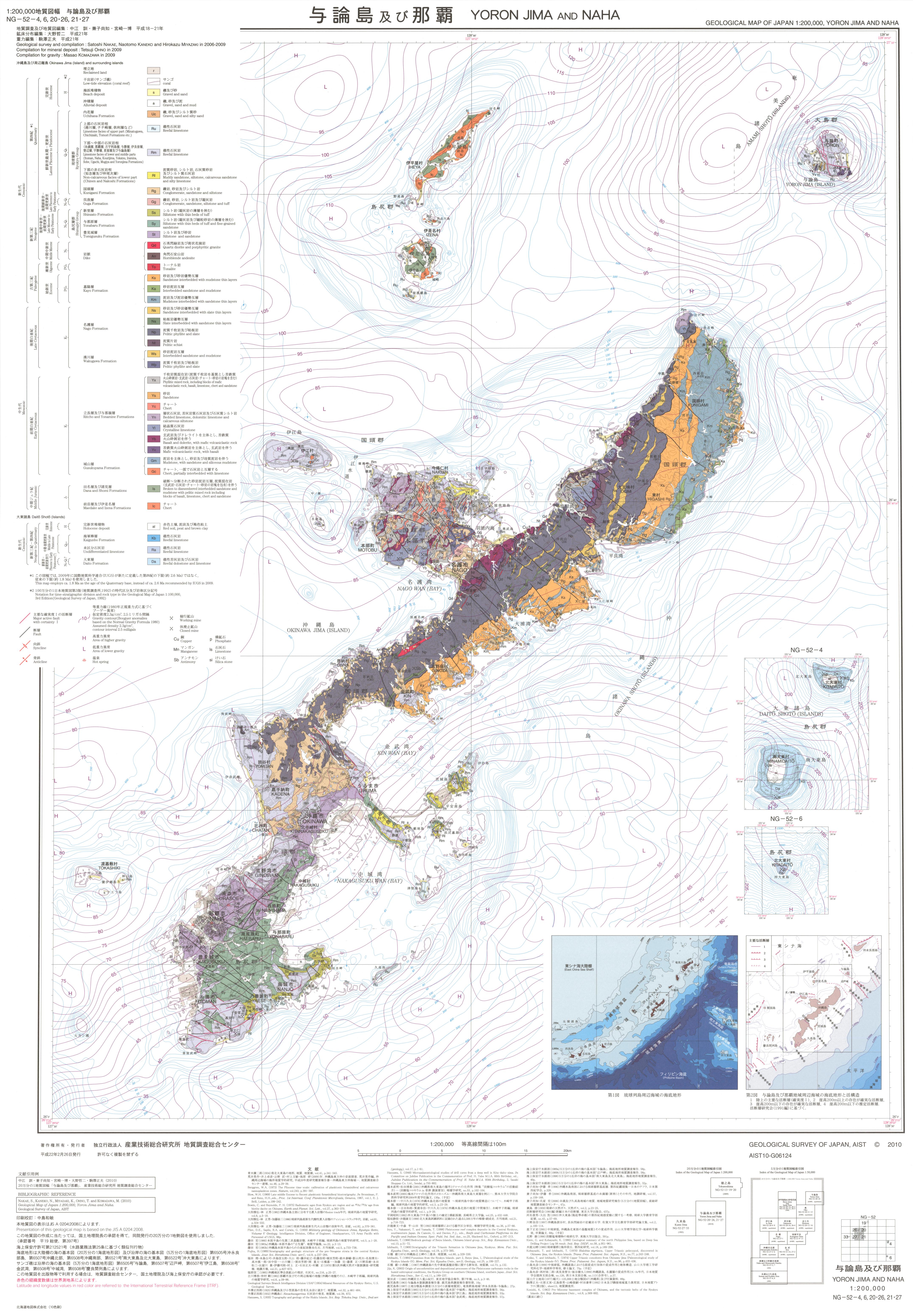
Map name
1:200K GeoMap 'Yoronto & Naha' (2010)
Series
Geological Map of Japan, 1:200,000
Author
NAKAE Satoshi, KANEKO Naotomo, MIYAZAKI Kazuhiro, OHNO Tetsuji, KOMAZAWA Masao
Tribute
NG-52-4,6,20・26,21・27, 1 sheet
Publish year
2010
Publisher
Geological Survey of Japan, AIST
@id
https://gbank.gsj.jp/ld/resource/publication/map/g200/map1179
location
Sheet 1
Sheet
Item
Content
TileJSON
https://gbank.gsj.jp/geonavi/maptile/v2/getTileJson/G200_NG52_20262127yoronto-naha.json
Original
Image
Content
https://gbank.gsj.jp/ld/resource/image/map/gsj_map_1179_org_1172.jpg
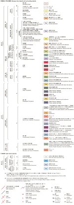
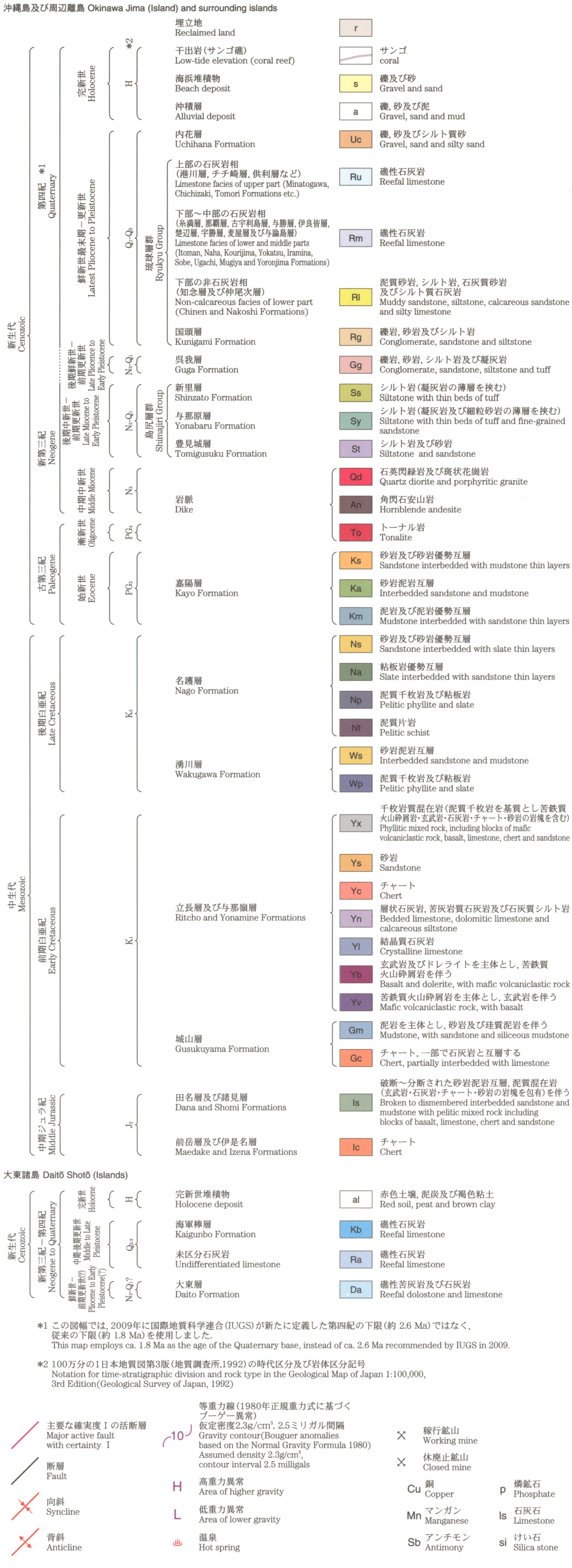
Legend
Image
Content
https://gbank.gsj.jp/ld/resource/image/map/gsj_map_1179_legend_1116.jpg
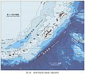
Appended figure
Item
Image
Content
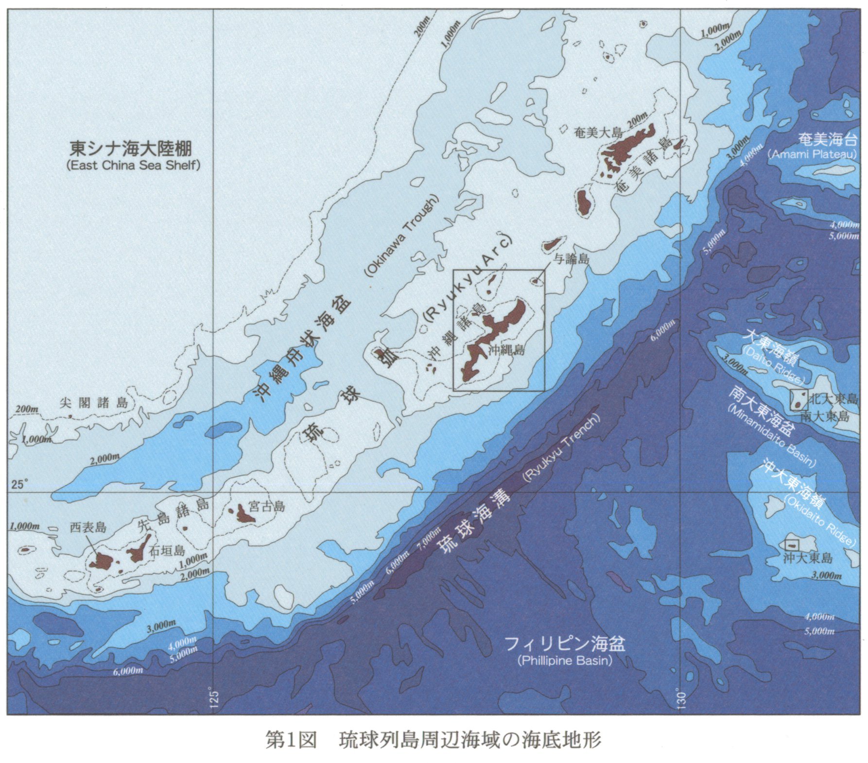
Seafloor topography around Ryukyu Arc
https://gbank.gsj.jp/ld/resource/image/map/gsj_map_1179_fig_877.jpg
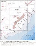
Seafloor topography and active structure around Naha
https://gbank.gsj.jp/ld/resource/image/map/gsj_map_1179_fig_878.jpg
References
https://gbank.gsj.jp/ld/resource/image/map/gsj_map_1179_fig_879.jpg
sameAs
分類
名称
URI
文献
中江訓,兼子尚知,宮崎一博,大野哲二,駒沢正夫 (2010) 20万分の1地質図幅「与論島及び那覇」
https://gbank.gsj.jp/ld/resource/geolis/201020543
isPartOf
分類
名称
URI
出版物シリーズ
Geological Map 1:200,000
https://gbank.gsj.jp/ld/resource/publication/map/g200
seeAlso
分類
名称
URI
Viewer
GeomapNavi: 1:200K GeoMap 'Yoronto & Naha' (2010)
https://gbank.gsj.jp/geonavi/geonavi.php?layers=1179
downloadData
形式
名称
URI
PDF
https://www.gsj.jp/data/200KGM/PDF/GSJ_MAP_G200_NG5227_2010_D.pdf
JPEG
https://www.gsj.jp/data/200KGM/JPG/GSJ_MAP_G200_NG5227_2010_200dpi.jpg
GeoTiff/KML
https://www.gsj.jp/data/200KGM/GTF/GSJ_MAP_G200_NG5227_2010.zip