Linked Data: Geological Survey of Japan
JSON
RDF
GSJ LD
Linked Data Service of GSJ
GSJ LD
Literature
Volcano
Specimen
Publication
Image
GSJ LD
>>
Publication
>>
map
>>
g200
>> map1048
GSJ Publication
item
description
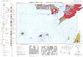
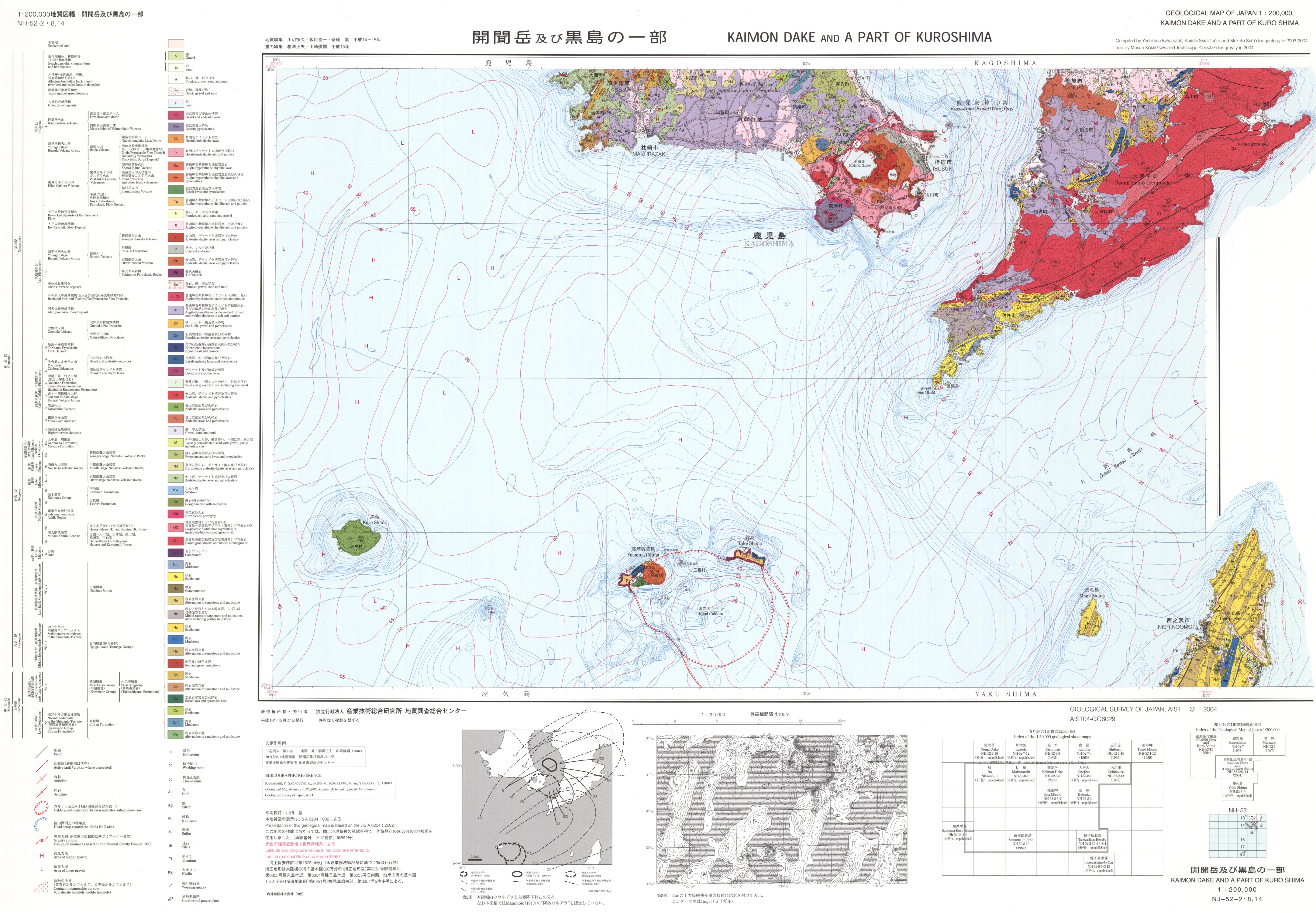
Map name
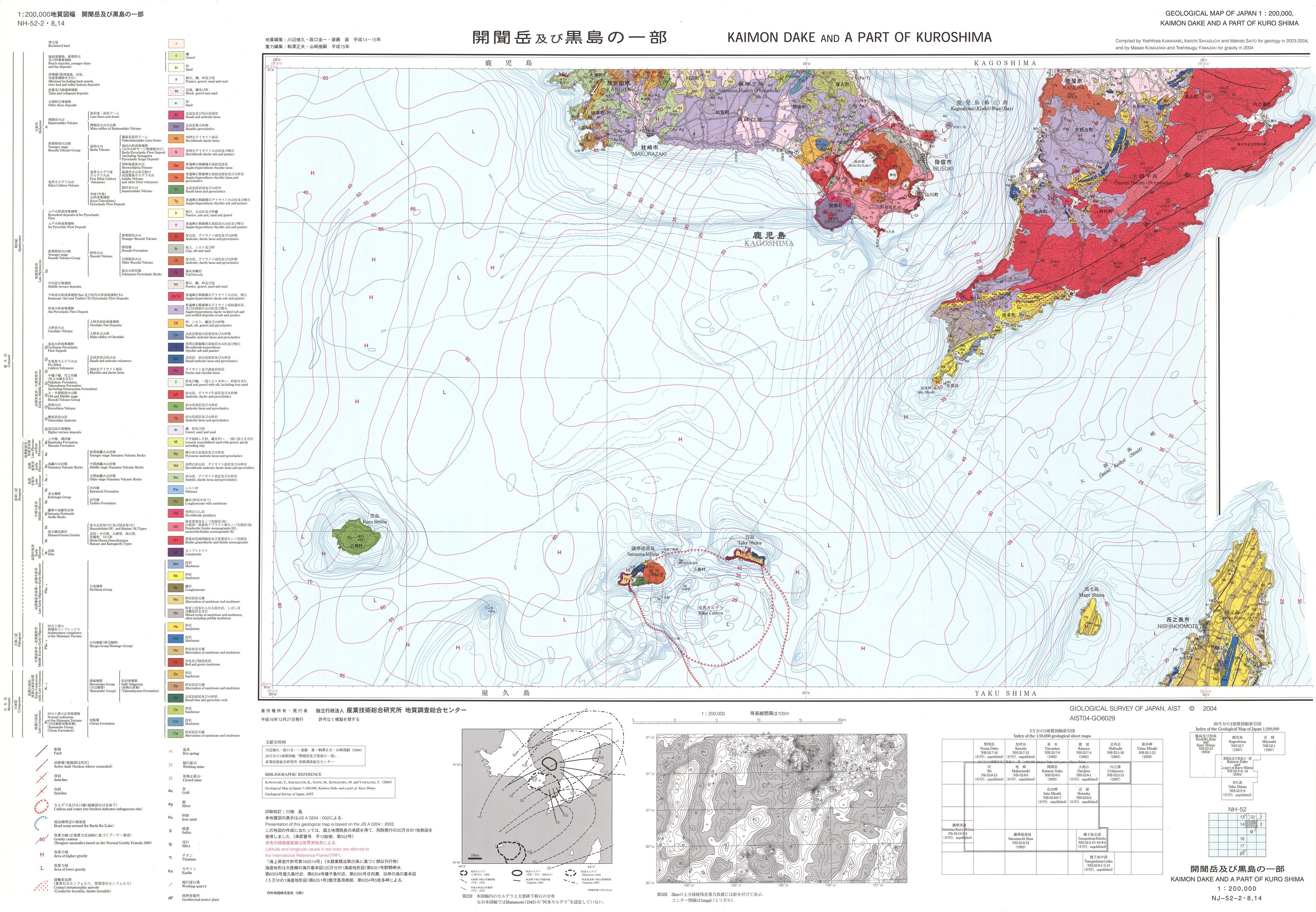
1:200K GeoMap 'Kaimondake & Kuroshima' (2004)
Series
Geological Map, 1:200,000
Author
KAWANABE Yoshihisa, SAKAGUCHI Keiichi, SAITO Makoto, KOMAZAWA Masao, YAMAZAKI Toshitsugu
Tribute
NH-52-2・8,14, 1 sheet
Publish year
2004
Publisher
Geological Survey of Japan, AIST
@id
https://gbank.gsj.jp/ld/resource/publication/map/g200/map1048
location
Sheet 1
Sheet
Item
Content
TileJSON
https://gbank.gsj.jp/geonavi/maptile/v2/getTileJson/G200_NH52_020814kaimondake.json
Original
Image
Content
https://gbank.gsj.jp/ld/resource/image/map/gsj_map_1048_org_1047.jpg
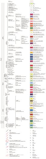
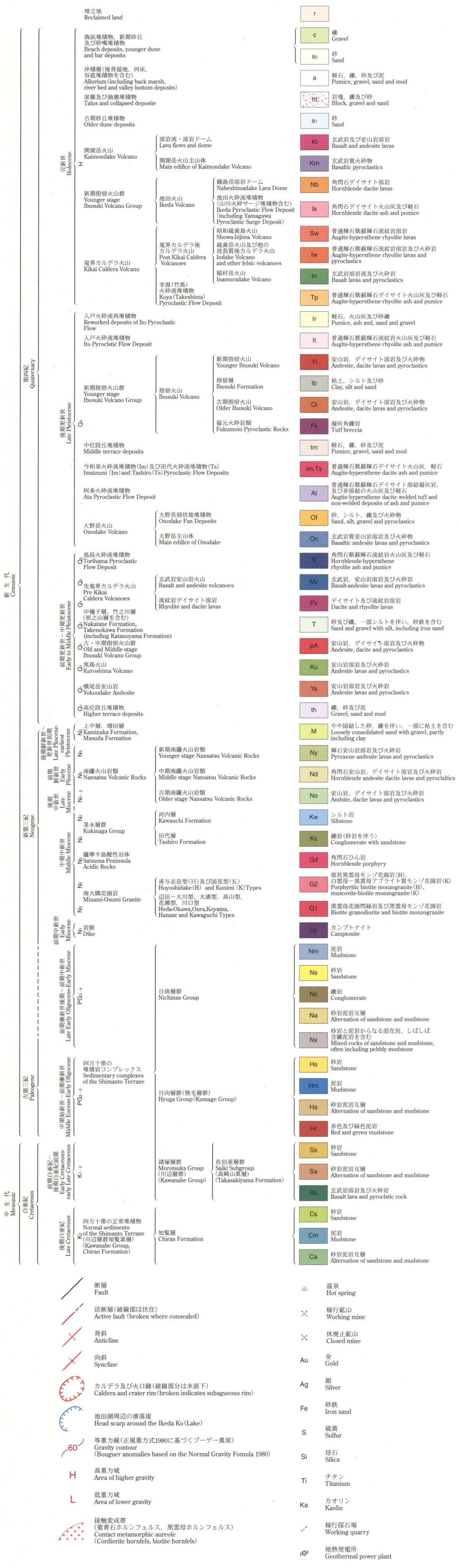
Legend
Image
Content
https://gbank.gsj.jp/ld/resource/image/map/gsj_map_1048_legend_5.jpg
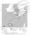
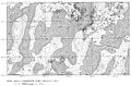
Appended figure
Item
Image
Content
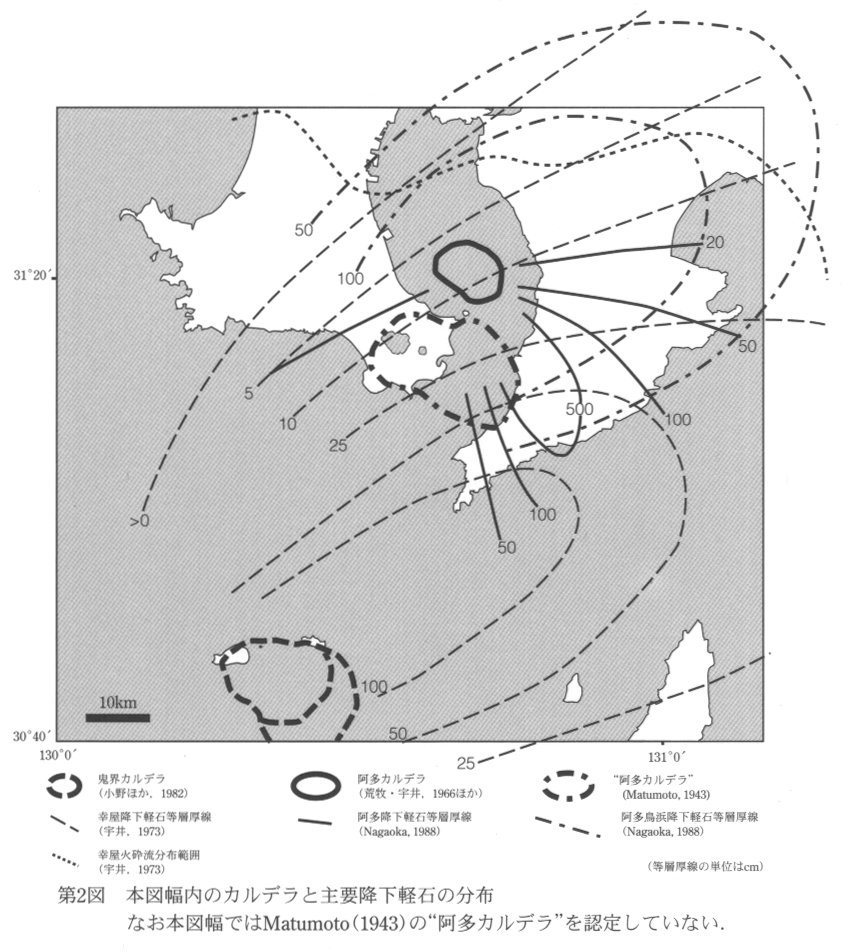
Distribution of caldera and major pumice fall
https://gbank.gsj.jp/ld/resource/image/map/gsj_map_1048_fig_118.jpg
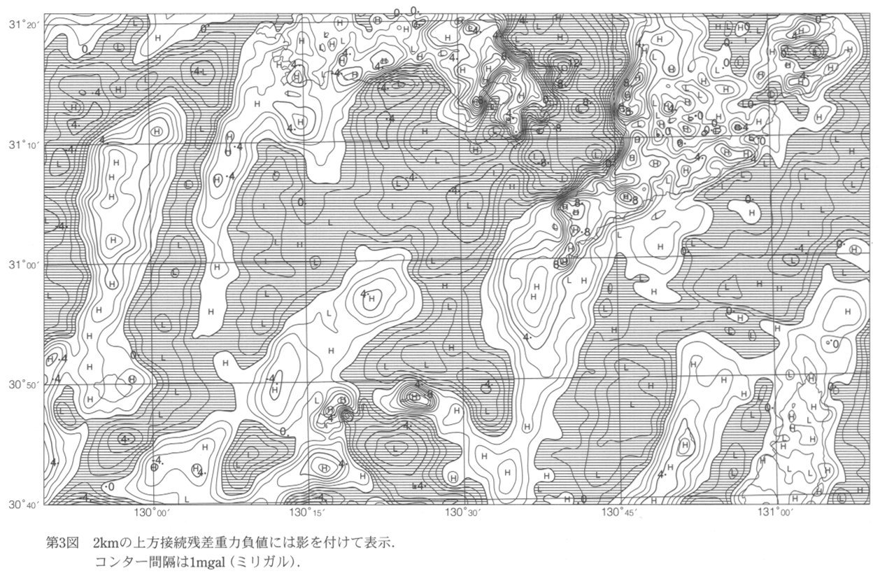
Residual gravity anomaly
https://gbank.gsj.jp/ld/resource/image/map/gsj_map_1048_fig_119.jpg
sameAs
分類
名称
URI
文献
川辺禎久,阪口圭一,斎藤真,駒沢正夫,山崎俊嗣 (2004) 20万分の1地質図幅「開聞岳及び黒島の一部」
https://gbank.gsj.jp/ld/resource/geolis/200522856
isPartOf
分類
名称
URI
出版物シリーズ
Geological Map 1:200,000
https://gbank.gsj.jp/ld/resource/publication/map/g200
hasPart
分類
名称
URI
鉱床・鉱徴地
要素グループ:鉱床位置情報
https://gbank.gsj.jp/ld/resource/mine/group/gsjmap1048
seeAlso
分類
名称
URI
Viewer
GeomapNavi: 1:200K GeoMap 'Kaimondake & Kuroshima' (2004)
https://gbank.gsj.jp/geonavi/geonavi.php?layers=1048
downloadData
形式
名称
URI
JPEG
https://www.gsj.jp/data/200KGM/JPG/GSJ_MAP_G200_NH5208_2004_200dpi.jpg
GeoTiff/KML
https://www.gsj.jp/data/200KGM/GTF/GSJ_MAP_G200_NH5208_2004.zip
PDF
https://www.gsj.jp/Map/errata/errata_200k_kaimondake.pdf