Linked Data: Geological Survey of Japan
JSON
RDF
GSJ LD
Linked Data Service of GSJ
GSJ LD
Literature
Volcano
Specimen
Publication
Image
GSJ LD
>>
Publication
>>
map
>>
g02m
>> map795
GSJ Publication
item
description
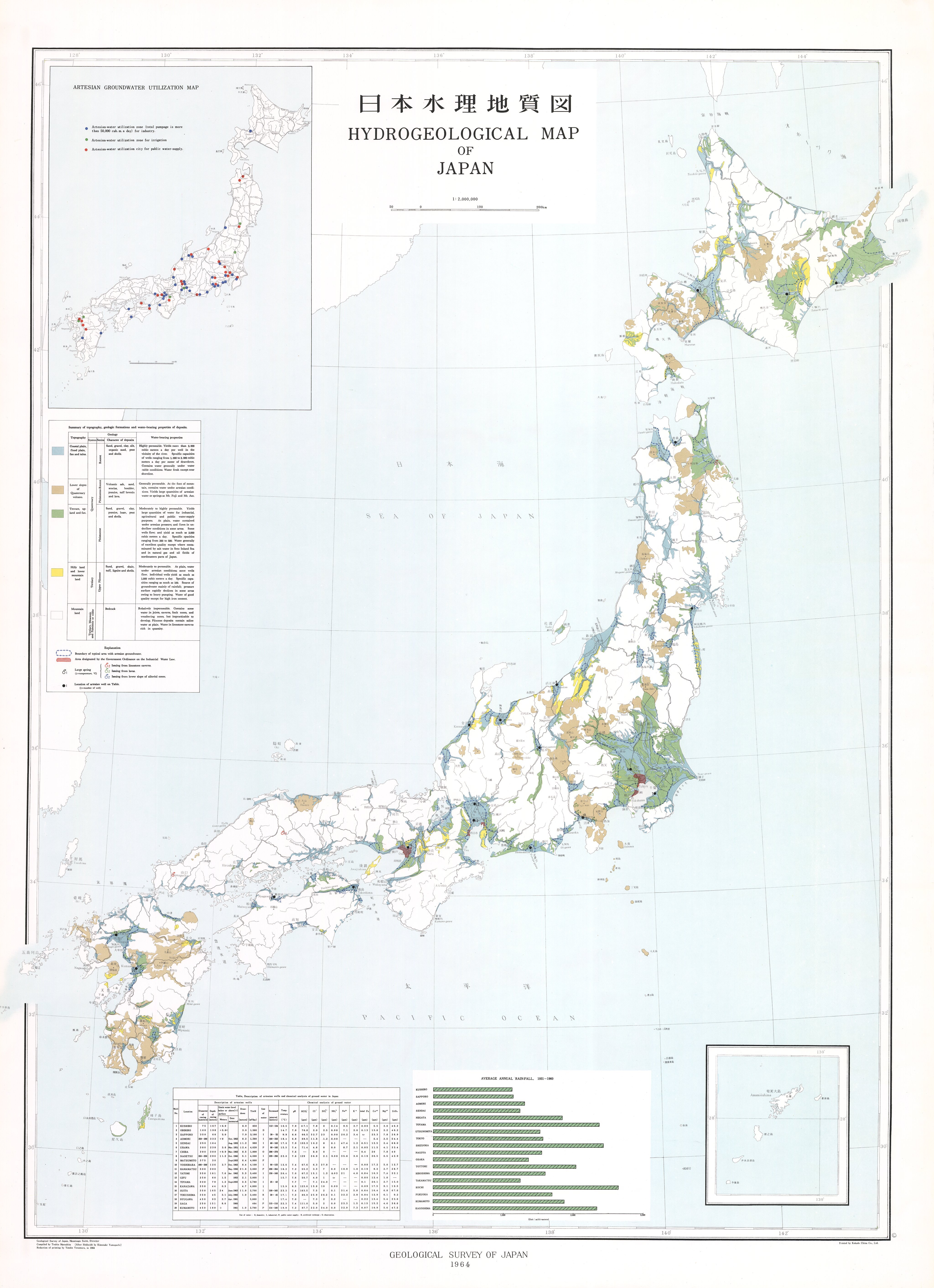
Map name
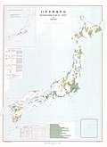
1:2M Map Series 'Hydrogeological Map' (1964)
Series
Map Series, 1:2,000,000
Author
MURASHITA Toshio, YAMAGUCHI Kunosuke
Tribute
10, 1 sheet
Publish year
1964
Publisher
Geological Survey of Japan
@id
https://gbank.gsj.jp/ld/resource/publication/map/g02m/map795
location
Sheet 1
Sheet
Item
Content
TileJSON
https://gbank.gsj.jp/geonavi/maptile/v2/getTileJson/TH_10hydrogeo.json
Original
Image
Content
https://gbank.gsj.jp/ld/resource/image/map/gsj_map_795_org_795.jpg
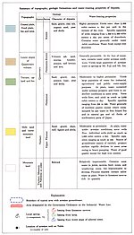
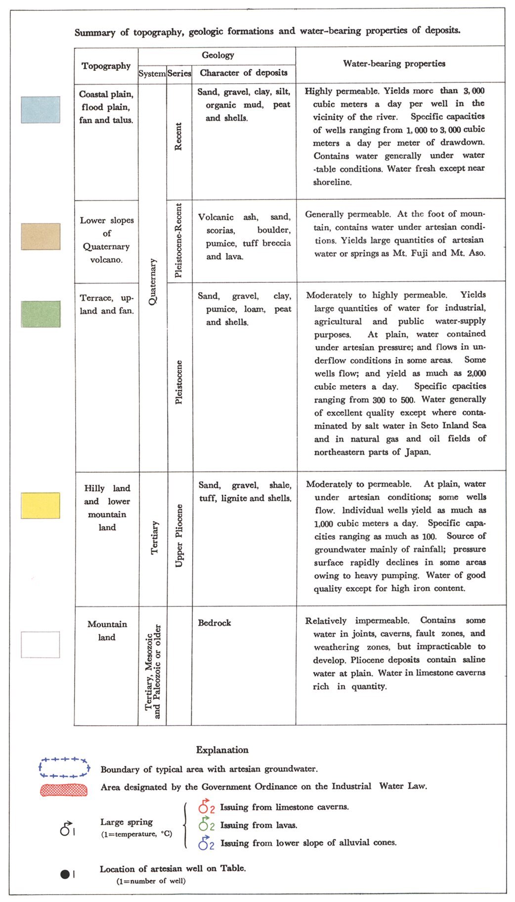
Legend
Image
Content
https://gbank.gsj.jp/ld/resource/image/map/gsj_map_795_legend_1066.jpg
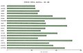
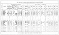
Appended figure
Item
Image
Content
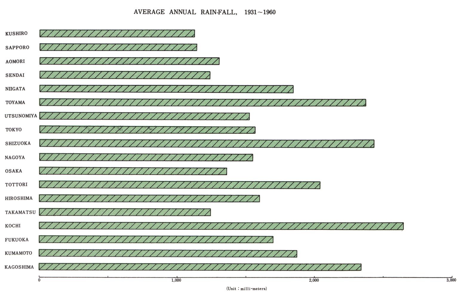
Average annual rain-fall
https://gbank.gsj.jp/ld/resource/image/map/gsj_map_795_fig_790.jpg
Water quality
https://gbank.gsj.jp/ld/resource/image/map/gsj_map_795_fig_791.jpg
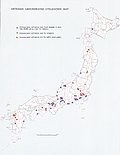
Artesian groundwater utilization map
https://gbank.gsj.jp/ld/resource/image/map/gsj_map_795_fig_792.jpg
sameAs
分類
名称
URI
文献
MURASHITAToshio,YAMAGUCHIKunosuke (1964) 日本水理地質図
https://gbank.gsj.jp/ld/resource/geolis/99905623
isPartOf
分類
名称
URI
出版物シリーズ
Geological Map 1:2,000,000
https://gbank.gsj.jp/ld/resource/publication/map/g02m
seeAlso
分類
名称
URI
Viewer
GeomapNavi: 1:2M Map Series 'Hydrogeological Map' (1964)
https://gbank.gsj.jp/geonavi/geonavi.php?layers=795
downloadData
形式
名称
URI
JPEG
https://www.gsj.jp/data/G02M/JPG/GSJ_MAP_G02M_010_1964_200.jpg