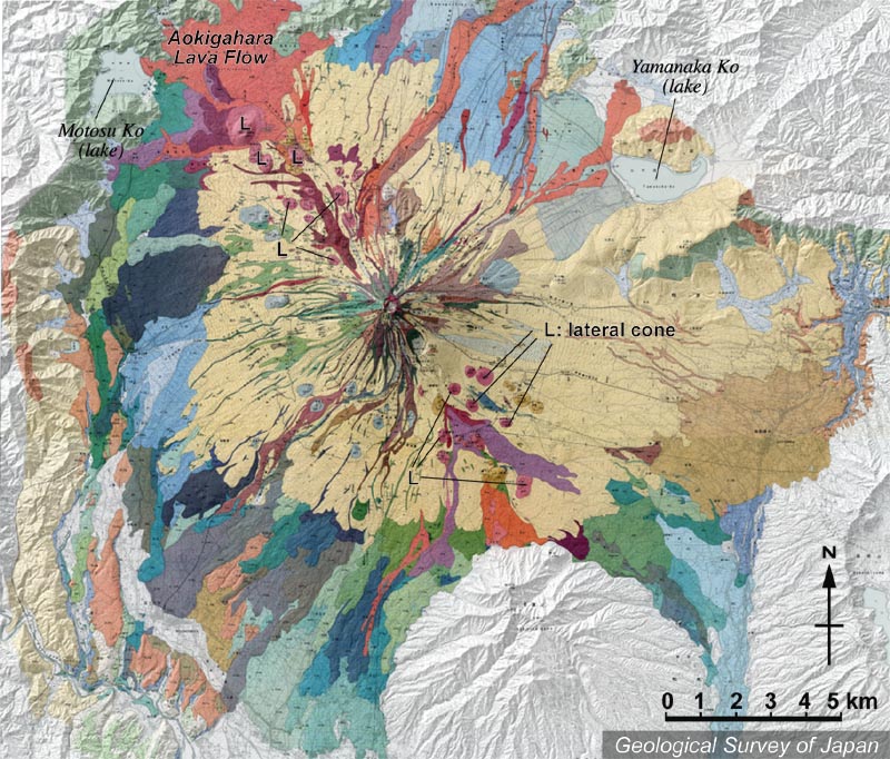
| 地質陰影図(北が上)。山頂を中心に北西-南東方向に卓越して、側火山が多数分布する。山頂付近からのみでなく、これらの側火口からも溶岩流が山麓まで流出している。 | |
|
|
| 地質調査総合センター編(2002)富士火山地質図(1:50,000)CD-ROM版、数値地質図G-9、地質調査総合センター。 | |||
| Topographic relief of Fuji Volcano combined with geological map, showing NW-SE trending lateral cones around the main cone. The lava flowed not only from the summit but also from these lateral cones. | Map
courtesy of K. Nakajima |
||