Web Services
The Geological maps below are available as Open Geospatial Consortium (OGC) Web Map Services (WMS) and Web Map Tile Services (WMTS).
What's New
-
[Important Notice] The host name for map distribution (WMS, WMTS) has been changed. (2024/05/10)
(Old) gbank.gsj.jp
(New) ows.gsj.jp
Please change the URL.
Note: The WMTS service host name for the "Seamless Digital Geological Map of Japan (1:200,000)" is "gbank.gsj.jp".
-
[Adding map] Quadrangle Series 1:50,000 (2026/01/09)
5 AOMORI section :
FUKAURA, HIROSAKI, HAKKODA SAN, IWADATE, NAKAHAMA, DAIRAKOZAN, NOSHIRO, TAKANOSU, UGO-HAMADA, MORITAKE, YONAIZAWA
6 AKITA section :
TOGA AND FUNAKAWA, GOJOME, ANIAI, MORIYOSHIZAN, HACHIMANTAI, AKITA, TAIHEIZAN, TAZAWAKO, SHIZUKUISHI, UGOWADA, KARIWANO, HONJO -
[Map update] Quadrangle Series 1:50,000 (2025/05/16)
11 KYOTO section :
UENO
15 KAGOSHIMA section :
TOMOCHI -
[Adding map] Quadrangle Series 1:50,000 (2025/05/16)
5 AOMORI section :
OHATA, SHIRIYAZAKI, CHIKAGAWA, KUROISHI, TOWADA, RIKUCHU-ONO and RIKUCHUNODA
6 AKITA section :
TARO, HAYACHINE SAN, MIYAKO, OHAZAMA, TSUCHIBUCHI, OTSUCHI, KARODAKE, KISAKATA, YASHIMA, ASAMAI, KAWASHIRI, HITOKABE, KAMAISHI, CHOKAISAN AND FUKURA, YUZAWA, YAKEISHIDAKE, RYORI, SAKATA, OSAWA, UZENKANEYAMA, SENMAYA, KESENNUMA, TSURUOKA, KIYOKAWA, IWAGASAKI, WAKAYANAGI, SHIZUGAWA, TSUYA, OBANAZAWA, FURUKAWA, WAKUYA, TOYOMA, OSU, AWASHIMA, YOSHIOKA, MATSUSHIMA, ISHINOMAKI, YORIISO, SENDAI, SHIOGAMA, KINKASAN and IWANUMA
7 NIIGATA section :
IIDESAN, TAMANIWA, KAKUDA, SOMANAKAMURA, KAMO, KITAKATA, NIHONMATSU, HARAMACHI AND OMIKA, MIYASHITA, WAKAMATSU, NAMIE AND IWAKI-TOMIOKA, KAKIZAKI, OKANOMACHI, OJIYA, SUHARA, TAJIMA, KAWAMAE AND IDE, TAKADA-SEIBU, TAKADA-TOBU, MATSUNOYAMA ONSEN, TOKAMACHI, HAKKAI SAN, TAKANUKI, TAIRA, IIYAMA, NAEBASAN, HIUCHIDAKE, NANTAIZAN, NAGANO, SUZAKA, KUSATSU, NUMATA, ASHIO and UTSUNOMIYA
8 TOKYO section :
SAKAKI, HARUNA SAN, TOCHIGI, NAKAMINATO, KOMORO, MAKABE, ISHIOKA, ISOHAMA, SUWA, TATESHINAYAMA, MAMBA, YORII, TAKATO, YATSUGATAKE, MITSUMINE, OMIYA, NODA, ICHINOSE, MITAKE-SHOSENKYO, ITSUKAICHI, OME, KOFU and HACHIOJI
10 KANAZAWA section :
KOTAKI, SHIROUMADAKE, GOHYAKKOKU, TATEYAMA, OMACHI, HIGASHIMOZUMI, YARIGATAKE and SHINANO-IKEDA
12 OKAYAMA section :
SAIGO, URAGO, ETOMO, SAKAIMINATO, MIHONOSEKI, AKASAKI, AOYA, TOTTORIHOKUBU, TAISHA, IMAICHI, MATSUE, YONAGO, DAISEN, KURAYOSHI, TOTTORINAMBU, WAKASA, IWAMI-ODA AND OURA, KISUKI, YOKOTA, NEU, YUMOTO, OKUTSU, YUNOTSU AND GOTSU, SAMBESAN, TARI, KAMIIWAMI and AKANA
13 KOCHI section :
TSUTA, HIROSHIMA, KAITAICHI, OTAKE, ITSUKU SHIMA, KURE, MITSU, IWAKUNI, KURAHASHI JIMA AND HASHIRA JIMA, IMABARISEIBU, OZU, IYOMISAKI and TSURUMISAKI
14 FUKUOKA section :
NII, SENZAKI, KATSUMOTO, ORIO, KOKURA, UBE, UBETOBU, GONOURA, ASHIBE, HIME SHIMA, YOBUKO, FUKUOKA, HIRADO, KARATSU, TOYOOKA, BUNGO-KITSUKI, SASEBO, IMARI, SAGA, HIZEN-ENOSHIMA, KAKINOURA, HAIKI and OMUTA
15 KAGOSHIMA section :
OJIKA JIMA, HIZEN-HIRASHIMA, FUKUE, TOMIE, DANJO GUNTO HOKUBU AND NAMBU, KONOURA, OMURA, MIEMACHI, KUMATA, HIZENTAKASHIMA AND NOMOSAKI, TOMOCHI, HINAGU, ONIKIZAKI AND USHIBUKA, NISHIKATA, KIRISHIMAYAMA, NAKAKOSHIKI, HASHIMA, SENDAI, KAJIKI (N. PART), KOKUBU, TARUMIZU, KANOYA, KAIMON DAKE and UCHINOURA -
[Map update] Quadrangle Series 1:50,000 (2025/05/16)
7 NIIGATA section :
IZUMOZAKI, SANJO, KASHIWAZAKI, NAGAOKA, ECHIGO-YUZAWA, TOGAKUSHI and NAKANO
8 TOKYO section :
KONOSU, TOKYO-SEINAMBU, FUJISAWA, YOKOHAMA, KISARAZU, ANESAKI, NANBU, YOKOSUKA, FUTTSU, SHIMIZU, ATAMI, MISAKI, NAGO, KAMOGAWA, SHIZUOKA, SHUZENJI, ITO, TATEYAMA, SHIMODA, INATORI, O SHIMA, OMAEZAKI, MIKOMOTOJIMA and TOSHIMA
9 HACHIJO JIMA section :
NII JIMA, KOZUSHIMA and MIYAKEJIMA
10 KANAZAWA section :
SUZUMISAKI_NOTO-IIDA AND HORYUZAN, KOGUCHISETO, OCHIGATA, ABUGASHIMA, MIKKAICHI, TSUBATA, ISURUGI, TOYAMA, UOZU, KANAZAWA, JOHANA, YATSUO, SHIROKIMINE, HIDA-FURUKAWA, FUNATSU, KAMIKOCHI, MATSUMOTO, FUKUI, MIKKAMACHI, TAKAYAMA, NORIKURADAKE, SHIOJIRI, ARASHIMADAKE, HAGIWARA, ONTAKE SAN, KISO-FUKUSHIMA, INA, KAMMURIJIMA, IMAJO AND TAKENAMI, NEO, HACHIMAN, GERO, KASHIMO, AGEMATSU, AKAHO, MIYAZU, TANGOYURA, NOKOGIRIZAKI, NISHIZU, TSURUGA, YOKOYAMA, TANIGUMI, MINO, KANAYAMA, TSUKECHI, TSUMAGO and IIDA
11 KYOTO section :
OEYAMA, MAIZURU, OBAMA, KUMAGAWA, CHIKUBU SHIMA, OMINAGAHAMA, OGAKI, GIFU, FUKUCHIYAMA, AYABE, YOTSUYA, KITAKOMATSU, HIKONE-SEIBU, HIKONETOBU, TSUSHIMA, NAGOYA-HOKUBU, SASAYAMA, SONOBE, KYOTO-SEIHOKUBU, KYOTO-TOHOKUBU, OMI-HACHIMAN, GOZAISHO YAMA, KUWANA, NAGOYA-NAMBU, ASUKE, SANDA, HIRONE, KYOTO-SEINAMBU, MINAKUCHI, KAMEYAMA, YOKKAICHI, HANDA, GOYU, MIKAWA-ONO, AKIHASAN, KOBE, OSAKA-SEIHOKUBU, OSAKA-TOHOKUBU, NARA, UENO, TSU-SEIBU, TSU-TOBU, MOROZAKI, TOYOHASHI AND TAHARA, HAMAMATSU, MITSUKE, SUMA, OSAKA-SEINAMBU, OSAKA-TONAMBU, SAKURAI, NABARI, IRAGO MISAKI, KAKEZUKA, KISHIWADA, YOSHINOYAMA, WAKAYAMA AND OZAKI, KOKAWA, KOYASAN, SANJO-GA-TAKE, KAINAN, TODOROGI, RYUJIN, KURISUGAWA, SHINGU, ATAWA, ESUMI, NACHI, TANAMI and KUSHIMOTO
12 OKAYAMA section :
CHIZU, OYAICHIBA, TAJIMATAKEDA, TSUYAMATOBU, SAYO, YAMASAKI, IKUNO, SUSAI, KAMIGORI, TATSUNO, HOJO, TAKASAGO and KASHI
13 KOCHI section :
SUMOTO, MISHIMA, KAWAGUCHI, HIBIHARA, INO, YAWATAHAMA, IYOTAKAYAMA, UWAJIMA, IYOKASHIMA and SUKUMO
14 FUKUOKA section :
BEPPU, OITA, SAGANOSEKI, MIYANOHARU, KUJU, INUKAI and USUKI
15 KAGOSHIMA section :
TAKEDA, SAIKI, MITAI, KAMAE, KURAOKA, MOROTSUKAYAMA, NOBEOKA, SHIIBAMURA, MIKADO, TOMITAKA, MURASHO, OSUZU YAMA, TSUNO, TSUMA AND TAKANABE, NOJIRI, MIYAZAKI, MIYAKONOJO, HYUGAAOSHIMA, SUEYOSHI, OBI, SHIBUSHI and OINOMISAKI -
[Add map] Quadrangle Series 1:50,000 (2024/05/10)
7 NIIGATA section :
IZUMOZAKI, SANJO, KASHIWAZAKI, NAGAOKA, ECHIGO-YUZAWA, TOGAKUSHI, NAKANO
10 KANAZAWA section :
FUNATSU, KAMIKOCHI, MATSUMOTO, TAKAYAMA, NORIKURADAKE, SHIOJIRI, HAGIWARA, ONTAKESAN, KISO-FUKUSHIMA, INA, GERO, KASHIMO, AGEMATSU, AKAHO, KANAYAMA, TSUKECHI, TSUMAGO, IIDA
Web Map Services (WMS) / Web Map Tile Services (WMTS)
Please use the address below for WMS/WMTS client or web service.
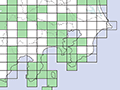
Quadrangle Series 1:50,000
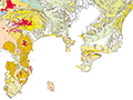
Seamless Digital Geological Map of Japan (1:200,000)
WMS
capabilities :
basic version
/
detailed version
WMTS capabilities : basic version / detailed version
detailed
WMTS capabilities : basic version / detailed version
detailed
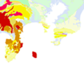
1:1,000,000 Geological Map of Japan
WMSWMS capabilities
https://ows.gsj.jp/ows/GSJ_Combined_Bedrock_and_Superficial_Geology_and_Age/wms
WMTSWMTS capabilities
https://ows.gsj.jp/tilemap/geologicmap/wmts/1.0.0/JPN_GSJ_1M_Combined_BLT_SLT_BA/default/{TileMatrixSet}/{TileMatrix}/{TileRow}/{TileCol}.png
https://ows.gsj.jp/ows/GSJ_Combined_Bedrock_and_Superficial_Geology_and_Age/wms
WMTSWMTS capabilities
https://ows.gsj.jp/tilemap/geologicmap/wmts/1.0.0/JPN_GSJ_1M_Combined_BLT_SLT_BA/default/{TileMatrixSet}/{TileMatrix}/{TileRow}/{TileCol}.png
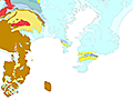
1:2,000,000 Geological Map of Japan
WMSWMS capabilities
https://ows.gsj.jp/ows/geologicmap2000k_en
WMTSWMTS capabilities
https://ows.gsj.jp/tilemap/geologicmap/wmts/1.0.0/geologicmap2000k/default/{TileMatrixSet}/{TileMatrix}/{TileRow}/{TileCol}.png
https://ows.gsj.jp/ows/geologicmap2000k_en
WMTSWMTS capabilities
https://ows.gsj.jp/tilemap/geologicmap/wmts/1.0.0/geologicmap2000k/default/{TileMatrixSet}/{TileMatrix}/{TileRow}/{TileCol}.png
1:2,000,000 Digital Geologic Map of East and Southeast Asia
WMSWMS capabilities
https://ows.gsj.jp/ows/GSJ_CCOP_Combined_Bedrock_and_Superficial_Geology_and_Age/wms
WMTSWMTS capabilities
https://ows.gsj.jp/tilemap/geologicmap/wmts/1.0.0/EASIA_CCOP_2M_Combined_BLT_SLT_BA/default/{TileMatrixSet}/{TileMatrix}/{TileRow}/{TileCol}.png
https://ows.gsj.jp/ows/GSJ_CCOP_Combined_Bedrock_and_Superficial_Geology_and_Age/wms
WMTSWMTS capabilities
https://ows.gsj.jp/tilemap/geologicmap/wmts/1.0.0/EASIA_CCOP_2M_Combined_BLT_SLT_BA/default/{TileMatrixSet}/{TileMatrix}/{TileRow}/{TileCol}.png
1:2,000,000 to 1:200,000 Seamless Geological Map of Japan
WMSWMS capabilities
https://ows.gsj.jp/ows/geologicmap_multiscale_en
WMTSWMTS capabilitiles
https://ows.gsj.jp/tilemap/geologicmap/wmts/1.0.0/geologicmap_multiscale/default/{TileMatrixSet}/{TileMatrix}/{TileRow}/{TileCol}.png
https://ows.gsj.jp/ows/geologicmap_multiscale_en
WMTSWMTS capabilitiles
https://ows.gsj.jp/tilemap/geologicmap/wmts/1.0.0/geologicmap_multiscale/default/{TileMatrixSet}/{TileMatrix}/{TileRow}/{TileCol}.png
Bouguer Anomalies in Japan
WMSWMS capabilities
https://ows.gsj.jp/ows/gravdb_en
WMTSWMTS capabilities
https://ows.gsj.jp/tilemap/gravdb/wmts/1.0.0/BouguerAnomaly200/default/{TileMatrixSet}/{TileMatrix}/{TileRow}/{TileCol}.png
(This service includes several layers. For a listing of available layers, please click the capabilities button. )
https://ows.gsj.jp/ows/gravdb_en
WMTSWMTS capabilities
https://ows.gsj.jp/tilemap/gravdb/wmts/1.0.0/BouguerAnomaly200/default/{TileMatrixSet}/{TileMatrix}/{TileRow}/{TileCol}.png
(This service includes several layers. For a listing of available layers, please click the capabilities button. )
Geological Map of Fuji Volcano
WMSWMS capabilities
https://ows.gsj.jp/ows/miscellaneous_00012_en
WMTSWMTS capabilities
https://ows.gsj.jp/tilemap/miscellaneous/wmts/1.0.0/miscellaneous_00012_en/default/{TileMatrixSet}/{TileMatrix}/{TileRow}/{TileCol}.png
https://ows.gsj.jp/ows/miscellaneous_00012_en
WMTSWMTS capabilities
https://ows.gsj.jp/tilemap/miscellaneous/wmts/1.0.0/miscellaneous_00012_en/default/{TileMatrixSet}/{TileMatrix}/{TileRow}/{TileCol}.png
Raster-based Web Map Tile Services (WMTS)
A large number of published maps is available on WMTS.
https://gbank.gsj.jp/geonavi/maptile/wmts/1.0.0/WMTSCapabilities.xml (in Japanese)
Images can be checked in the map browser "GeomapNavi".
How to Use
WMS and WMTS are available in some GIS applications such as ArcGIS, QGIS, Google Earth, etc.
Web applications such as OpenLayers can view the maps of WMS and WMTS within your website.
Terms of Use
The license of the geological maps of WMS / WMTS is Government of Japan Standard Terms of Use (Version 2.0) .
If you need to contact us, please use Inquiry Form.