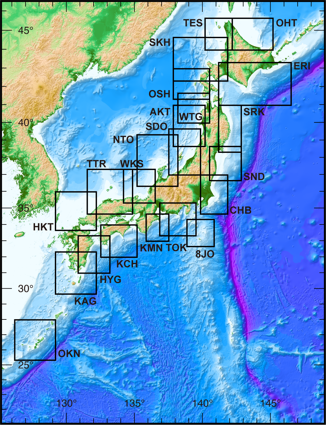
| List of the areas | |
| Japan Sea | Pacific Ocean |
| Teshio (TES) | Cape Erimo(ERI) |
| Syakotan Peninsula(SKH) | Sanriku (SRK) |
| Okushiri Island (OSH) | Sendai Bay (SND) |
| West of Tsugaru (WTG) | Chiba (CHB) |
| Akita (AKT) | Hachijo Island (8JO) |
| Sado Island (SDO) | Tokai (TOK) |
| Noto Peninsula (NTO) | Kumano (KMN) |
| Wakasa Bay (WKS) | Kochi (KCH) |
| Tottori (TTR) | East of Kyushu (HYG) |
| Hakata (HKT) | Ryukyu Arc |
| Sea of Okhotsk | Kagoshima (KAG) |
| Sea of Okhotsk (OHT) | Okinawa Island (OKN) |